

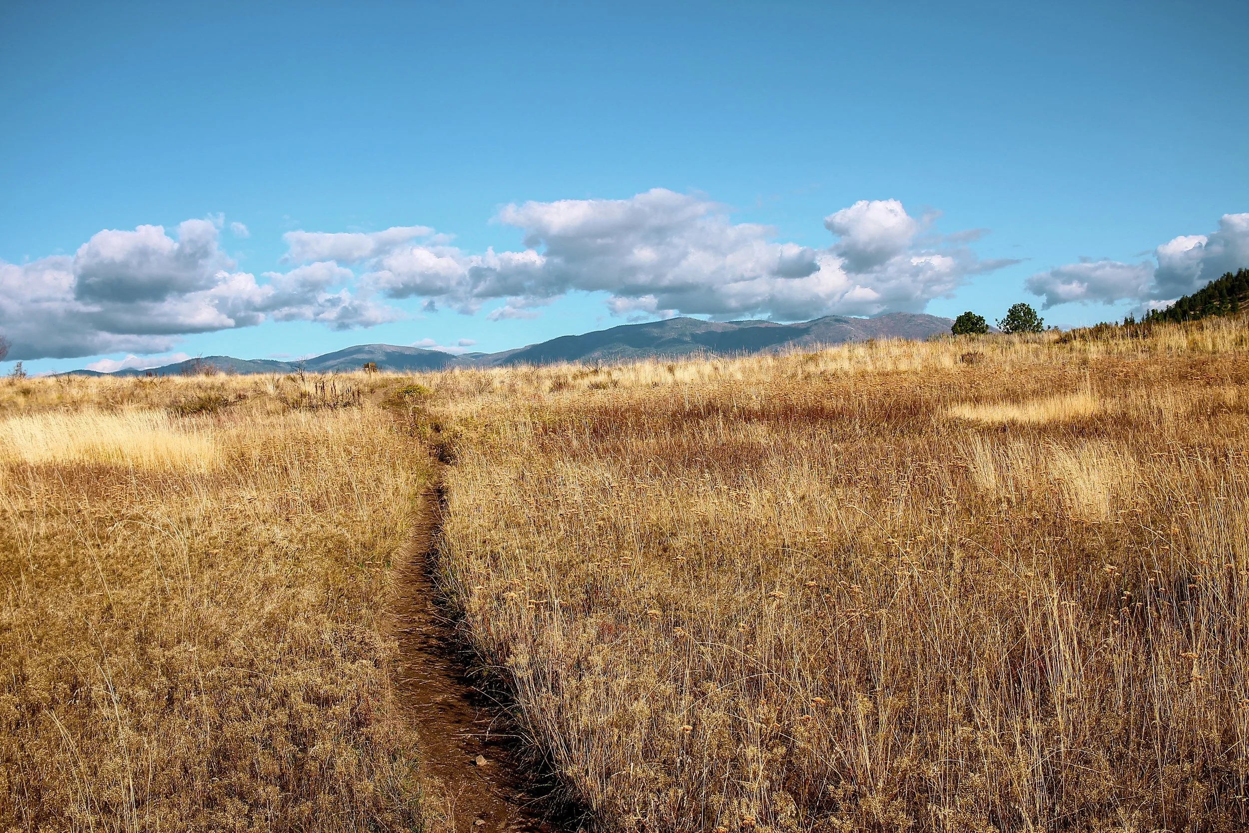
I am grateful to live in a world where Octobers exist. To me, October has always felt like an interval of change. A reshuffling of patterns, places, routines. An unsettling of things. This is particularly evident in the backcountry, which takes on a curious character this time of year. By curious, I mean there exists an undercurrent of acceleration. A heightened sense of urgency. Fleeting daylight. Sharpening temperatures. Bristly weather. All of this to say the time is now. Consequence feels amplified. Senses piqued. The riding, that much more zesty with the window about to close. Summer's predictably long days are suddenly condensed into a month of explosive vividry. Otherworldly reds, oranges, yellows, coppers, caramels, golds, and every flaxen variation flare into peak regalia only to disappear at the height of their powers.

Words & Photos | Ron Lewis, Illustrations | Chris Russell, Additional Photos | Abdulraman Alkhamees, further exploration | ben rainbow


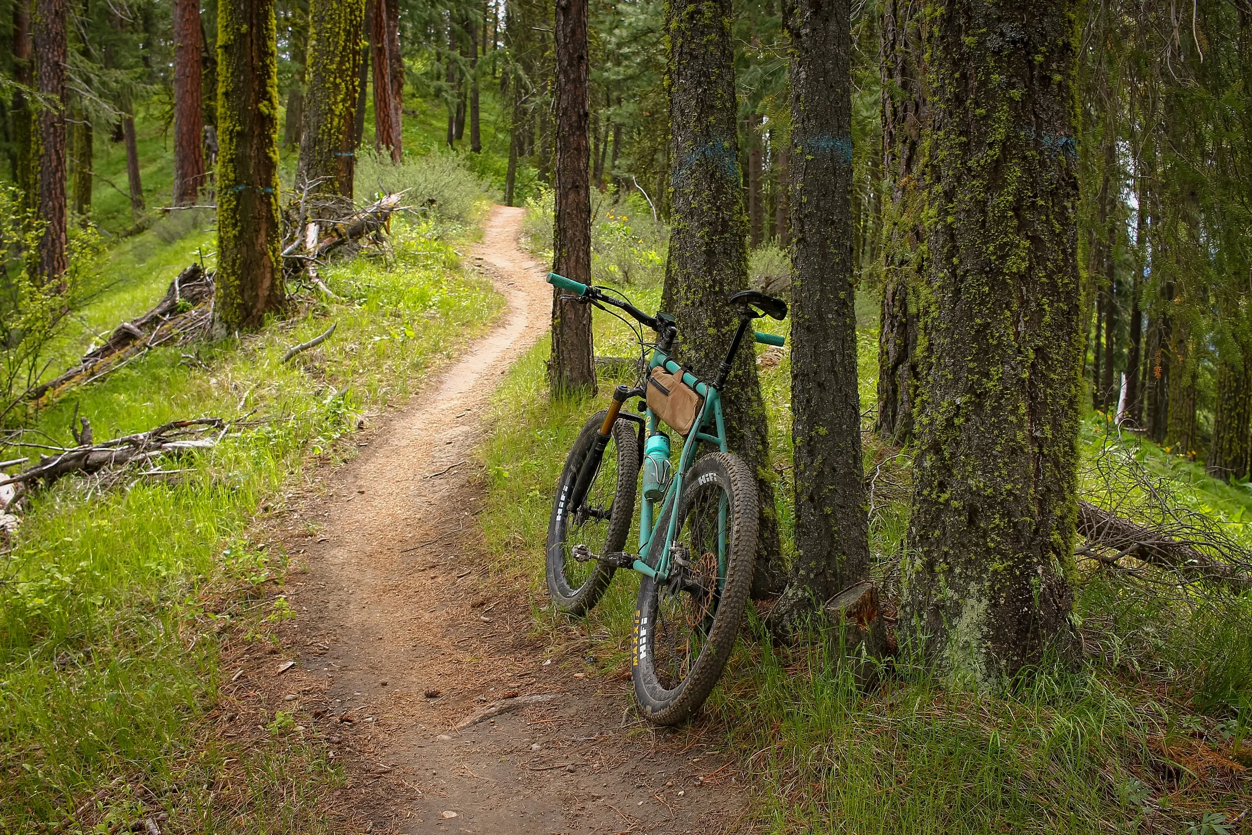
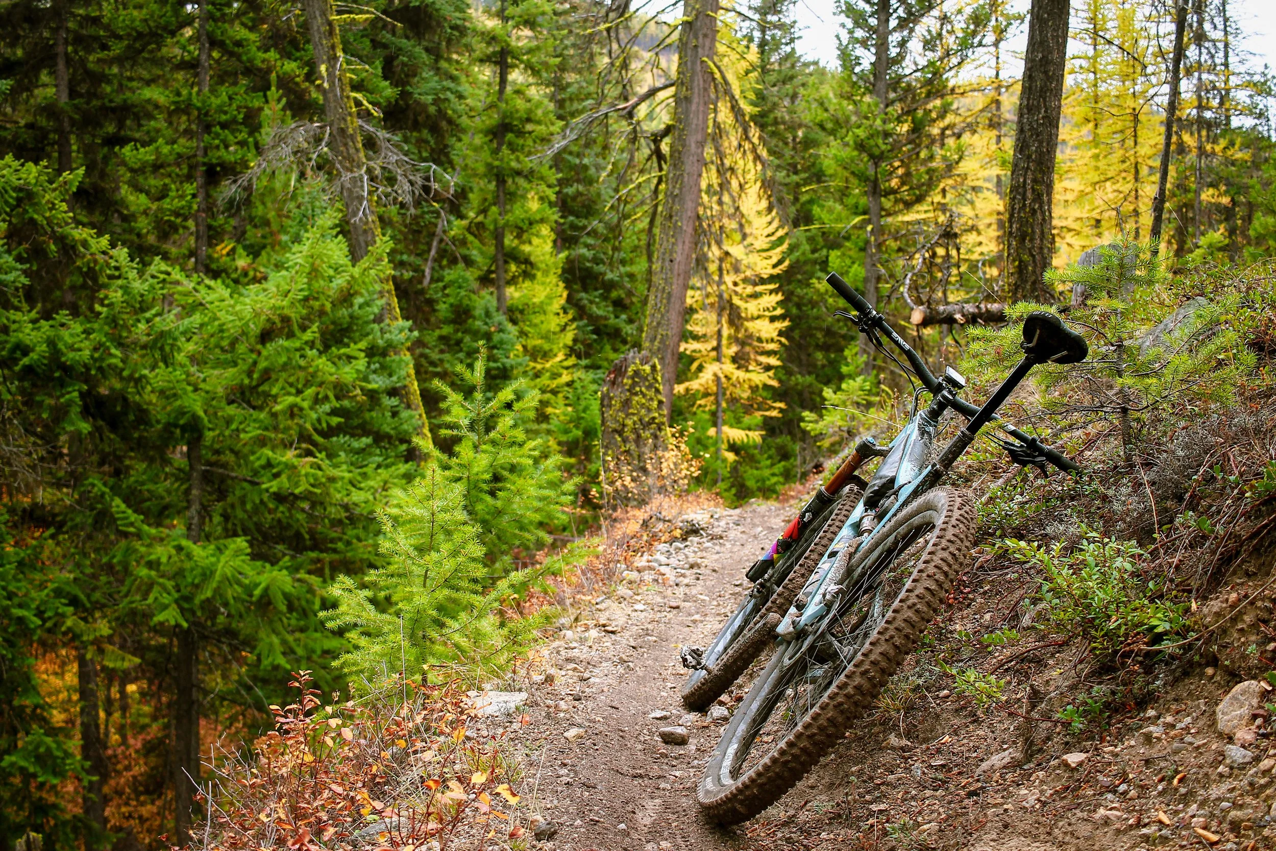
Cascadian mountain biking finds its purest form in late fall. The last upcountry tracks of the season are absolutely sublime – chasing autumn down to the moment it dissolves into winter, the curtain closing with every turn. There is nothing quite like it. In an effort to wring maximal joy from these minimal slivers of opportunity, over the past two years I have logged similar runs of high country mountain bike rides stretching from Portland, OR, up through Washington’s central Cascade rain shadow, west through the North Cascades to finish along the coast in Bellingham. Late September through early October promises anywhere from a couple weeks to a month of reasonable riding left with conditions guaranteed to vary wildly from one location to the next. And vary they always do – in the best of ways.
When adventures hit all the right beats with just the right timing – as these most exceedingly did – I’m inclined to share the experience. As such, the following eight rides present a full spectrum of seasonal flavors, some of the absolute best fall riding in the high Cascades, each chosen for its distinct character, palette and expression of the season. The purpose here is not only to recommend some of our favorite rides in the conventional sense, but to flesh out a holistic sense of place, multisensory experience and celebrate the distinctly Cascadian character of these backcountry treasures.
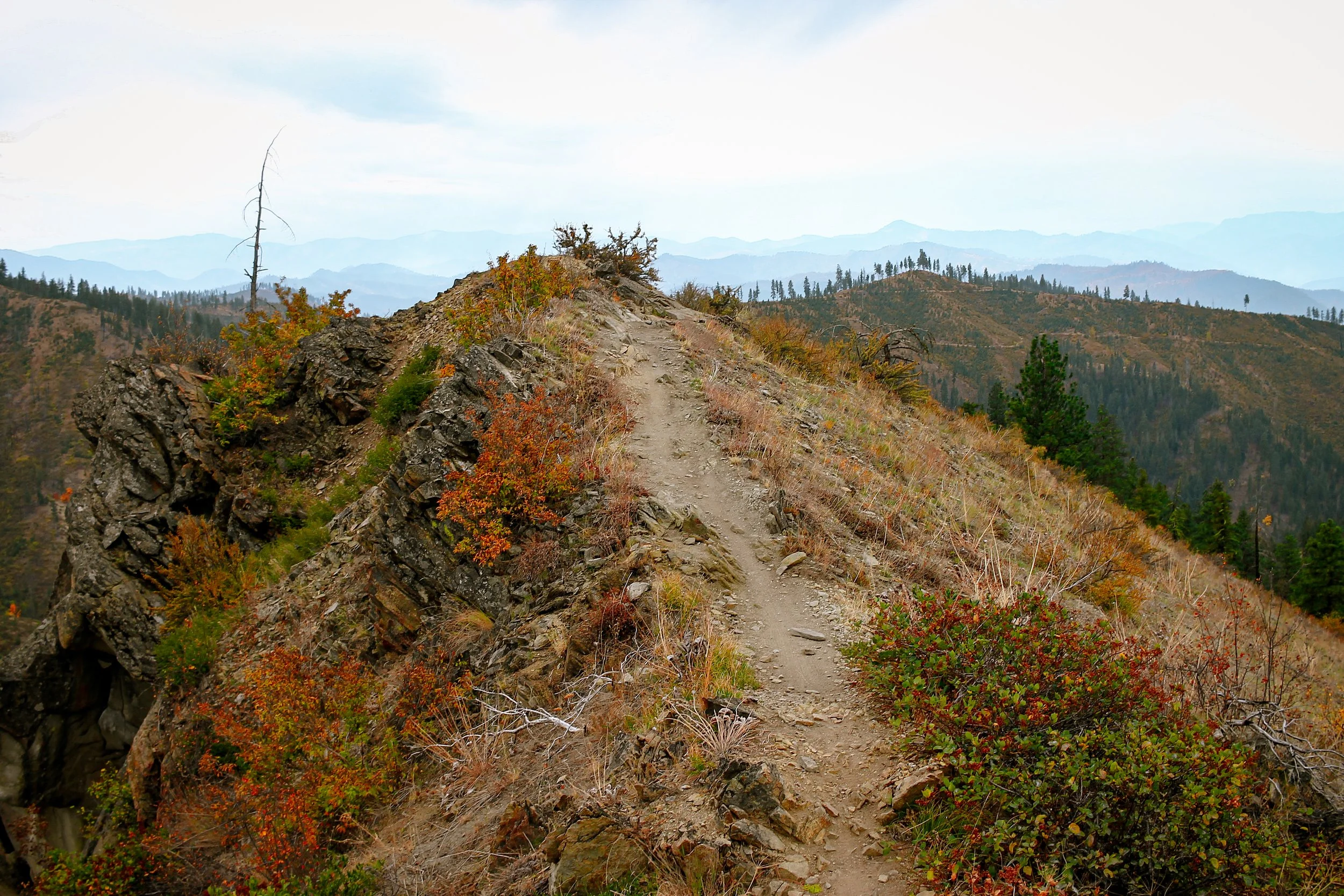
Gunsight Butte. Mt Hood, OR
Flavor Profile | Subalpine evergreen, horsehair lichen, blazing understory, andesitic minerality, thermal pockets, milky glacial silt and sunwarmed pinesap.
Gunsight Butte traces the eastern shoulder of Oregon's Mt. Hood National Forest. Admittedly much of Mt. Hood and its environs can feel a tad overexposed between the busy trailheads, tourist lodges and popular lakes, but if you know where to look, there is still plenty of peripheral quietude to be found. Places like Gunsight Butte, East Fork and the upper Fifteenmile high country still feel abundantly wild – the domain of marmot, western larch and cascading scree. You'll have to work for it, but will be richly rewarded for doing so.


noteworthy
Gunsight Butte is our favorite kind of trail – a backcountry corridor which starts and finishes deep in the good stuff without much fanfare. Just an unassuming path leading off into the woods. This uncut gem dips in and out of subalpine forest and open meadow, climbing 820 feet over 5 miles with massive views east and west. Its tread alternates between rich chocolate cake and loose, rocky basaltic shale, peppered with pitchy climbs with naturally embedded root and rock features. The trail is punctuated by several craggy outcrops and open talus fields – isolated slides of tumbling rock bearing a faint impressionistic through-line. While there are multiple ways to approach Gunsight within the context of a larger ride, this orientation packs some of our favorite lines in the 44 Trails network, roping in Cook’s Meadow, Surveyor’s Ridge, Dog River and the elusive East Fork.
Difficulty: Challenging
Distance: 45 miles
Elevation: 6591 feet
Estimated time: 5-6 hours
Bike: Hardtail, XC, Trail
Further exploration
Because Gunsight Butte is a short, point-to-point backcountry trail, it makes the most sense built into a larger ride within the 44 Trails network. Some folks like to shuttle from Bennett Pass to popular descents like Dog River or Surveyor’s Ridge. My preference is generally to loop it into a bigger backcountry mountain bike day via one of four configurations presented in this collection. Each has its own distinct flavor and flow. One starts by climbing Dog River for a gradual ascent into the 44. Another drops Cooks Meadows to Dog River to climb the highly underrated East Fork Trail. The third traverses Lookout Mountain, Cedar Creek, and Fifteenmile. The fourth begins at Pocket Creek Sno Park, climbs past the start of Gunsight and heads south for a big loop through the Boulder Creek drainage before returning to finish with Gunsight and Gumjuwac Trails.
44 TRAILS
Gunsight Ridge and neighboring trails are managed and maintained under the stewardship of the 44 Trails Association, who put in countless volunteer hours each season to keep these regional treasures open and running. 44 Trails is a volunteer-driven 501(c)3 non-profit working to maintain and improve the existing trail network as well as advocate for and build new trails to create a thoughtful and cohesive recreation network. 44 Trails members work closely with federal, state and local government agencies as well as numerous other volunteer organizations.
Ancient Trade corridors
The nexus of multiple ecological zones, Wy’east was almost by default, a significant meeting ground for a wide range of intersecting indigenous cultures. The area currently designated as Mt. Hood National Forest comprises the ancestral homelands of Clackamas Chinook, Cascade Chinook, Molalla, Tenino, Wasco and Warm Springs peoples since time immemorial. Long before the Barlow wagon trail was forged, native pathways and seasonal trade routes provided critical east-west access between the arid Tygh Valley corridor, through the Cascade foothills across Wy’east’s southern flank. This region provided essential hunting, resource gathering and conduits for trade between Molalla, Wasco-Wishram and Warm Springs tribes.


Mountain Lion
One could ride a lifetime in the Cascades without catching so much as a glimpse of these spectral cats. That said if you spend any amount of time hiking or riding in the backcountry, it is almost certain you have been watched by one at some point. Mountain Lion are renowned for their stealth and despite their widespread presence throughout the Cascades, these crepuscular creatures are rarely seen or heard by humans.
Horsehair Lichen
This wispy treeborne fungi, also called Bryoria fremontii, has a name in at least twenty different Indigenous languages. As you may expect, its lengthy tendrils sway in the breeze like the mane of a horse or a wizard's beard, adorning the high branches of Douglas Fir and Lodgepole Pine. This living organism thrives in open coniferous canopies and defoliated limbs between 4000 feet and the timber line – a ubiquitous presence in the high Cascades. Horsehair Lichen has long been an Indigenous dietary staple. Packed in these long, shaggy wisps are dense servings of carbohydrates, traditionally harvested using long, hooked sticks then soaked, boiled, or cooked in earthen pits with layers of root vegetables.
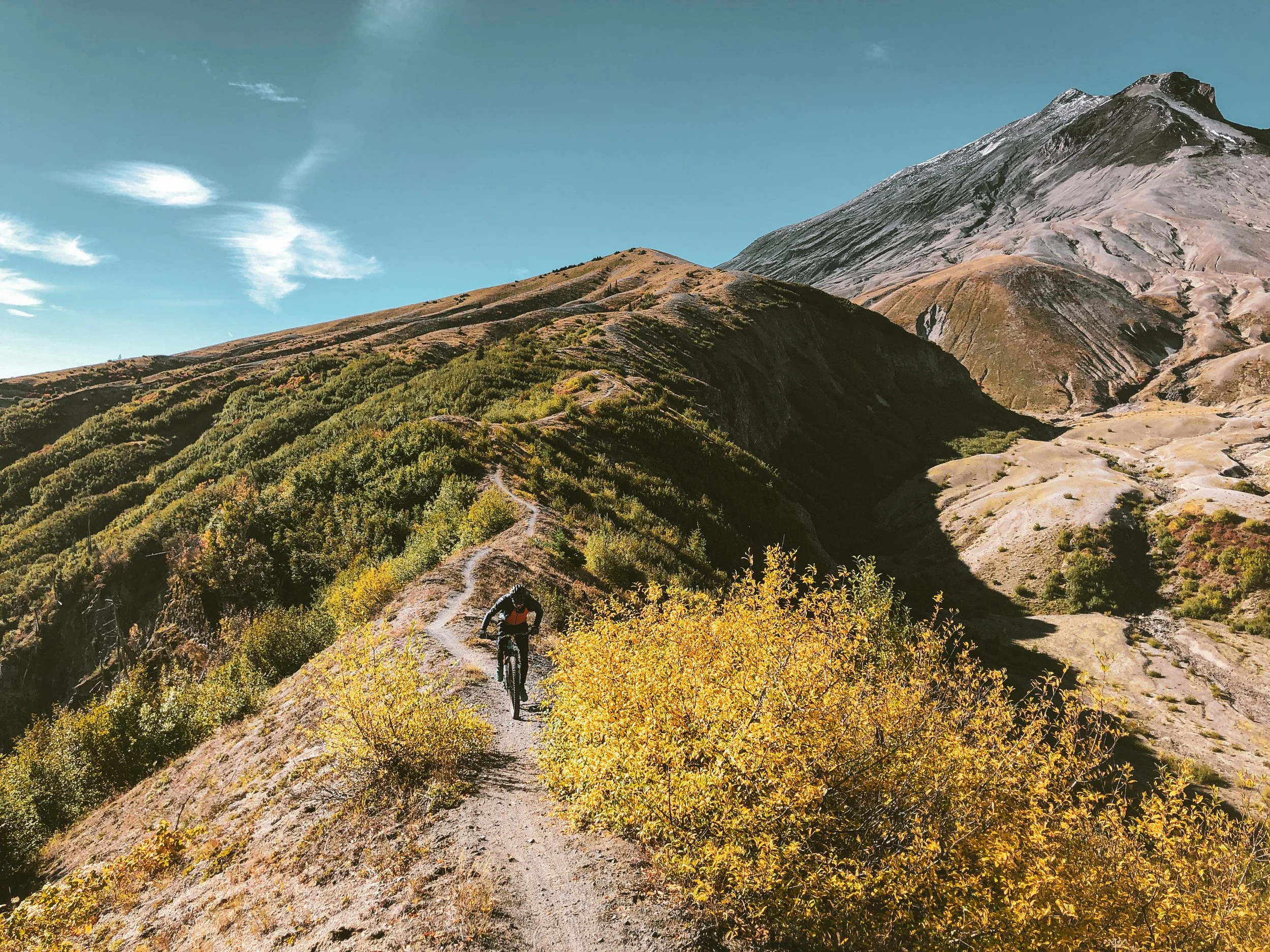
Goat Mountain to Vanson Ridge. Green River Valley, WA
Flavor Profile | alpine montane, exposed rocky outcrops, sandy pumice saddles, stonecrop, saxifrage, lupine and beargrass up high – ancient old growth cedar, Douglas fir, western Hemlock and soft diffused light down low.

Less of a conventional bike ride and more of a holistic circumnavigation of this richly-layered ecosystem, Goat Mountain sits within the Green River adventure nexus of superlative singletrack on the north side of Mt St Helens. The Green River drainage and ridges of Goat, Vanson and Tumwater Mountains survived the 1980 eruption more or less intact because they were shielded from immediate impact by the peaks and prominences of the Mount Margaret Backcountry, which bore the brunt of the lateral blast of ash and debris. Shaped by cataclysm and regeneration, the Green River micro-region presents a dynamic blend of exposed rocky ridgelines, pristine mountain lakes and impossibly lush lowland river valleys.


Noteworthy
Goat Mountain to Vanson Ridge is just one configuration of many within this highly-concentrated region of otherworldly backcountry singletrack. Other options include Tumwater, Goat Creek, Strawberry Ridge and Boundary Trails in close, accessible proximity. The loop as shown consists of four basic stages: the climb from Green River Horse Camp, the exposed saddle and Deadmans Lake, the descent from Vanson Peak and the 6.5 miles of lowland valley riding along the Green River Trail to close the loop. Each section has its own unique character, challenges and rewards. Best of all, everything is neatly contained within the wild and wonderful Green River Valley, its namesake campground centrally located within range of any number of deeply rewarding backcountry adventures.
trans-cascadia
In 2018-2019 Trans-Cascadia put thousands of collective hours into revitalizing the Goat/Vanson/Tumwater trail complex which was languishing away, overgrown and unmaintained. Trans-Cascadia partners with trail stewards and advocacy groups (primarily EMBA and WTA in this case) to reclaim, build, maintain and protect backcountry mountain bike trail resources throughout the Pacific Northwest.
Lawetlat’la the Smoking Mountain
Lawetlat'la, Loowit or Louwala-Clough, the sacred smoking mountain of Cowlitz, Klickitat and Yakama legend, erupted May 18th 1980, triggering the largest known debris avalanche in recorded history. Yet within the context of Indigenous memory, this was a blip – a recent cataclysm in a much larger chain of ancient eruptive periods. Cowlitz legend describes Lawetlat’la as a once-peaceful, sleeping mountain that became grief-stricken and angry. Loowit has long been considered a living entity by Cowlitz, Klickitat and Yakama peoples, its mercurial presence in their lands symbolic of ancestral wisdom, enduring connectivity and conflict between human and terrestrial realms.

Difficulty: Intermediate
Distance: 19.6 miles
Elevation: 4089 feet
Estimated time: 5-6 hours
Bike: Hardtail, XC, Trail
Further exploration
Quartz Creek Big Trees trailhead: a petite side quest to be with a few remaining massive and majestic old growth Western Redcedars, rare in this area of intense logging operations and eruptive activity. Let the trees reboot your imagination and creativity.
Norway Pass: experience the dynamic effects of destruction and tenacity in the blast zone. Hike out along the Boundary Trail (bikes allowed, but hard to recommend due to challenging terrain), push on to the Windy Ridge/Spirit Lake lookout.
Strawberry Ridge: prototypical Cascades, yet singular sense of place. Blue/Dark Blue ridgeline singletrack trail with deep Gifford Pinchot vastness, an enveloping and dynamic forest, pumice fields and numerous telltale signs of the violent eruption of May 18th, 1980.

Beargrass
Subalpine Beargrass is a Cascadian high country staple. It has long, grasslike leaves that emerge from a central clump. These coarse, stiff, narrow leaves help beargrass survive in harsh, nutrient-poor mountain environments. In early summer, Subalpine Beargrass’ characteristic cream-colored flower stalks can reach 2-3 feet in height. The blooms’ sweet, delicate fragrance imparts a rich, botanical nose to the high-elevation meadows and ridgelines of Goat Mountain and Vanson Peak
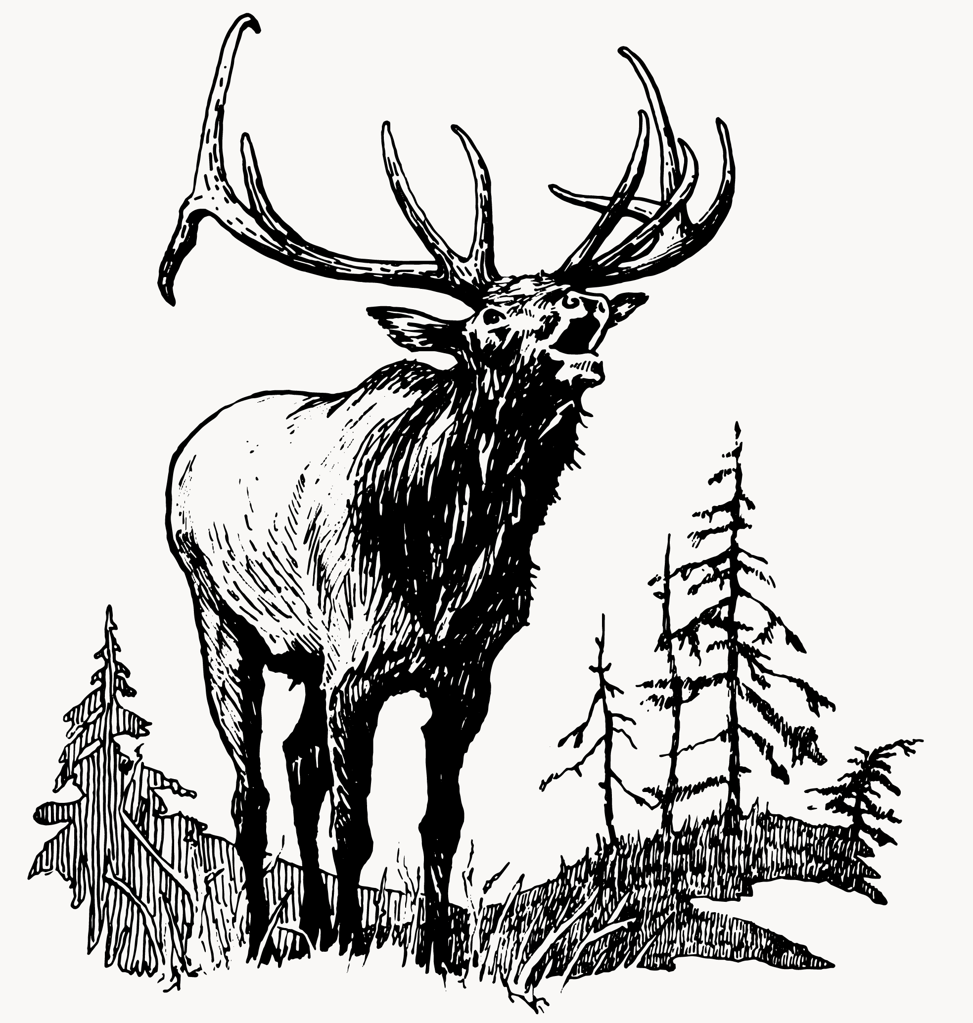
Wapiti
Primal and haunting, the hollow, throaty squeal of bugling Bull Elk seems the absolute essence of wildness. Once heard, this feral song is not easily forgotten as it reverberates through the night-woods. Cervus canadensis also called Wapiti, thrive in the temperate rainforest, alpine meadow, and dense riparian woodland of the Cascadia bioregion, their earthy brown coats blending seamlessly with the misty, moss-covered landscapes. The Elk living in Cascadia today are descendents of the great herds whose historical numbers were second only to the buffalo across the North American continent.
Ape Canyon to Smith Creek. Mt St Helens, WA
Flavor Profile | Piney duff, timeworn roots, sandy pumice plain, rubblestrewn runoff channels, lithic lahar flows, debriscoured hummockforms, meltwater floodplains, whitebarked red alder, sword fern and moss.
Consecrated as the stuff of legend, the Ape Canyon to Smith Creek loop exists on a short list of regional rites of passage. Renowned for its monolithic scale, commanding beauty and expansive diversity of volcanic terrain, Loowit’s challenging-yet-accessible southeast side is considered a classic for a reason. Beyond the obvious appeal of riding on semi-active volcano, this loop is a study in tension and release – a dynamic progression of contrasts from intimate to expansive, exposure to enclosure and back again. Densely forested ridgeline becomes barren, rocky sunbaked plain becomes damp, shaded river valley – all within 23 highly engaging miles.


Noteworthy
This iconic loop consists of three distinct sections: Ape Canyon, the pumice plain and the wild and wonderful Smith Creek Trail. Ape Canyon is a moist, rooty and densely forested climb into the pumice plain, an expanse of rocky washes, gullies and meltwater channels beneath Loowit’s glaciated rim. Crossing the plain, the Abraham Trail navigates an array of rippled hummocks (topographical mounds created by large-scale erosion and seasonal runoff) which rise and fall playfully, carpeted with stunted foliage and sunbleached husks of trees leveled in the 1980 blast. Think steep, sandy, loose, open and fast.
Smith Creek plays counterpoint by immediately plunging 2500 feet along exposed side-slopes deep into the valley below. The descent is loose and rutted, zig-zagging through overgrown passageways into the treeline over soft, sandy pumice. Rarely is the term dirt surfing so suitably applied. The terrain gradually eases into a shady river valley thick with red alder, moss and fern. The lower valley navigates several creek crossings, losing then rejoining the trail in places before a long steady climb out of the valley. Think deep, dank fantasy fairytale forests and portals of exquisite loam.

Cowlitz Vision Quests
In Cowlitz tradition, vision quests were undertaken as transformative initiations from childhood into adult identity. Variations of this rite of passage were practiced across the geographically distinct groups of the Upper Cowlitz, Lower Cowlitz, Mountain Cowlitz, and Lewis River band peoples. Each seeker pursued divine guidance for a life well-lived – one that would bring honor and value to their village and family.
The journey began with an individual ascending into the higher elevations, closer to the divine, to fast, pray, and meditate. Wandering was part of the process, as seekers tuned into signs revealed through their prayers and meditations. These signs often appeared in the form of an animal encounter, the murmur of a river, the roar of a waterfall, the bugling of bull elk, thunder, lightning, or the rustle of wind through trees.
For those who felt a connection to the sacred Cedar, a path as a skilled carver might emerge. One aligned with pliable plants or trees might become a master basket weaver. Fasting and praying continued until a sign resonated deeply, inspiring a song unique to the seeker. This song, practiced and refined, became an indelible part of their identity. Similarly, some were moved to express themselves through a distinct and personal style of dance. There were no time limits on a vision quest – unfolding as long as it took to find clarity and purpose.

Difficulty: Intermediate
Distance: 23 miles
Elevation: 3903 feet
Estimated time: 4-5 hours
Bike: Hardtail, XC, Trail


Further exploration
Lewis River Trail: a Gifford Pinchot deep cut that’s just out-of-the-way enough to require intentional planning, but oh boy does it deliver. Blue/Green riverside singletrack sessions, high concentration of old growth tree spotting, cascading waterfalls for hot weather respite, and mostly low trafficked. Late season as opposed to early season visits ensure the trail has been thoroughly cleared. The Lewis River Trail can be broken into upper and lower sections. The upper section is where you will find all of the waterfalls and consequently, the lion’s share of the foot traffic. The lower section is quite a bit more technically challenging, so something to keep in mind when taken as a whole.
NWTA & SHIFT
The Ape Canyon to Smith Creek loop is maintained by the dedicated stewardship of the Northwest Trails Alliance (NWTA) and their annual SHIFT (St. Helens International Festival of Trails) volunteer work events. NWTA is a Portland-based non-profit committed to advocacy for and creation, enhancement and protection of mountain biking opportunities and regional trail access.


RED ALDER
After the devastation of the 1980 St Helens eruption, Red Alder was among the first species of flora to bounce back, repopulating disturbed soils and thriving in the moist, well-draining riparian margins of lowland valleys. Red Alder is renowned for its ability to fix nitrogen via symbiotic partnership with bacterium Frankia, which enriches nutrient-poor volcanic soil environments like those of lower Smith Creek.
ANCESTRAL VOLCANISM
Loowit launched its eruptive career in the Pleistocene epoch, about 37000 years ago, during the most recent of Earth’s glaciated ice ages in what is known as the Ape Canyon Stage of ancestral activity. This would be the first of many eruptive cycles to spew plumes of andesite, dacite, hot pumice and ash throughout the region. Catastrophic mudflows would follow, scouring the surrounding landscape, creating massive, deeply furrowed runoff channels. These colossally destructive forces known as lahars would shape the mountain’s unique geological and aesthetic character for millenia.
Xanadu – Tres Hombres. Peshastin, WA
Flavor Profile | Sagebrush shrub steppe, bigleaf maple, ponderosa and knobcone, undulant ridgelines, arid meadows, insect pulse and chirp, colossal slabs, glacial erratics, Chumstick sandstone and shale.
The Xanadu – Tres Hombres trail complex is an anomalous treasure nestled in the central Cascadian foothills above Peshastin, WA. This fantastic double loop was added spontaneously on the recommendation of a friend with exquisite taste in backcountry riding. It pays to ask around. While it is part of a broader continuum of trail systems and backcountry corridors between Wenatchee and Leavenworth, Xanadu – Tres Hombres feels like local labor of love with destination-worthy appeal. This is a prime example of quality over quantity. The Xanadu circuit clocks in at a modest 13 miles with 3380 feet all in, but with terrain this dynamic, the numbers only tell part of the story.


Noteworthy
Xanadu and Tres Hombres are really two separate trail rides, companion pieces of one another, that when taken together comprise two mirror-image halves of a whole. Both follow the same basic formula: exposed sandy tread, rocky ridgelines and sandstone slabs up top descending into the treeline via steep, fast chutes and serpentine berms through the lower sections. Each stretch of singletrack comes with its own corresponding sequence of climb roads with exquisite views of the Enchantments and surrounding foothills.
P'squosa Peoples
P’squosa or Wenatchi peoples trace much of their origin to the era of the Great Floods or the cataclysmic breakup of the glacial ice dam(s) known as the Missoula Flood which transformed the entire Columbia River plateau and shaped the Gorge as it exists today. P’squosa translates to the people in between as reference to their location between the Cascades and the Columbia.

Difficulty: Intermediate
Distance: 13 miles
Elevation: 3380 feet
Estimated time: 2-3 hours
Bike: XC, Trail
FURTHER EXPLORATION
Leavenworth Ski Hill: full array of challenging and fun singletrack network trails (Freund Canyon, Rosy Boa, New Uphill Trail, etc) for a half or full day at the region's MTB park. Built and maintained by the Central chapter of the Evergreen Mountain Bike Alliance just a chip and a putt from the heart of Leavenworth.
Icicle Ridge: challenging as either an out-and-back or looped with Fourth of July, sits to the south and above Leavenworth. A worthy destination in the wildflower season (Apr-May). Be warned however, Leavenworth is no secret and gets hella busy.
Road Bike Rides: venture up Icicle Road to the end of the line and the main entrance to The Enchantments. Oh, you’ve never heard of the Enchantments?
Old Blewett Pass: if you arrived from Seattle via Hwy 97 rather than US2, you passed by the old time Blewett Pass off to the right just as the road begins to climb. With its decaying and unmaintained pavement, cars are off-limits. A shorty out and back would be the ~5m/1100ft from the south or 5.5m/1600ft from the north approach. The full shebang nets you just about 20 miles and about 3500 of climbing. Popular with randonneurs and discerning touring cyclists, this feather-in-the-cap ride can be taken on in all but the worst conditions.
Evergreen Mountain Bike Alliance
We like to think of Evergreen as the voice of Washington’s mountain bike community. Evergreen (or EMBA) acts as a single point of contact representing thousands of mountain bikers across Washington when working with land managers, politicians and other government agencies towards common goals of resource protection and recreational access. Last year Evergreen donated more than 10,000 volunteer hours to trail maintenance and building new trails. Learn more about Evergreen’s volunteer Trail Work Parties here. The Xanadu – Tres Hombres trail complex is maintained by EMBA’s central chapter whose purview stretches from Leavenworth to Wenatchee to Chelan and includes some of the best riding in the state!
the chumstick formation
It is 46 million years ago, deep in the Eocene epoch. A series of major tectonic faults rupture the raw primordial landscape. Plates push, pull, collide, grind, and subduct. There is a lot going on. Volcanoes erupt. Basin emerge. Highlands uplift. Grabens are formed when slivers of the Earth's crust lower relative to neighboring faults on either side. Colossally powerful rivers ferry all manner of rocky detritus through these valleys. Over time, these sandstone, shale, and interbedded volcanic ash sediments compact and compress into layers up to six miles thick. Meet the Chumstick Formation. These ancient sandstone slabs feature prominently in the Xanadu and Tres Hombres riding experience, underlying the circuit's spectacularly exposed ridges, vertical strata and precipitous drops.

Quaking Aspen
Like golden coins shimmering in the light, Quaking Aspen’s delicate, heart-shaped leaves flutter at the slightest breeze, setting alight impressionistic waves of soft, textural rustling. Beneath the surface, Aspen’s roots form vast, interconnected colonies, spreading life across forest floors and creating groves that are, in essence, one single communal organism. In autumn, Quaking Aspen’s golden palette charges the landscape with a luminous glow, spent foliage transforming the forest floor into an ocean of sunkissed radiance.
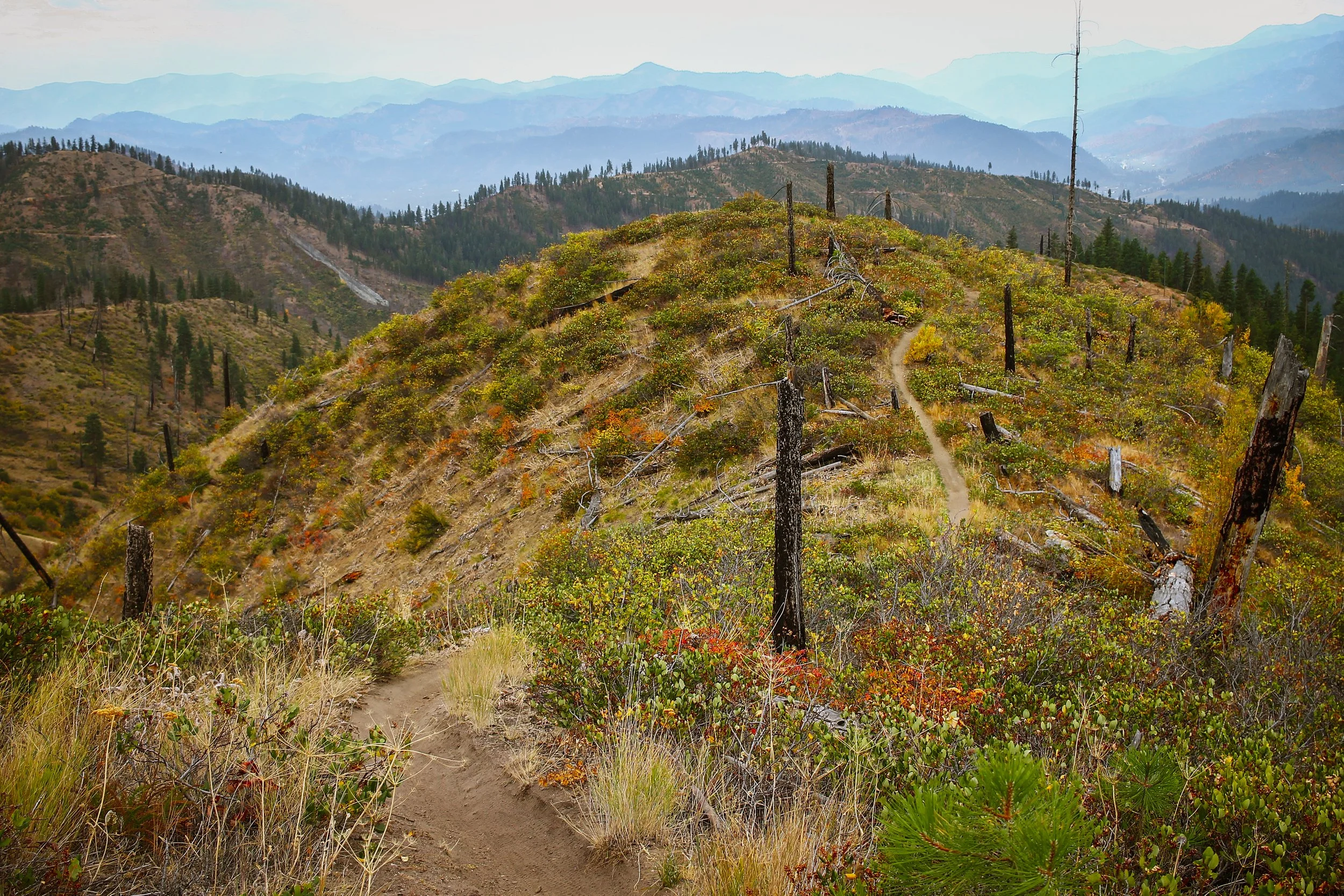
Starvation Mountain. Okanogan National Forest, WA
Flavor Profile | Semi-arid rainshadow, black cottonwood, white birch, golden larch, firescarred pinebark, granite, ash and sandy smoke, soft cinnamon and cocoa powder tread.

Starvation Mountain is an intimate slice of Okanogan understatement, which is to say a deep cut of old school XC singletrack showcasing the region’s rugged topography, narrow canyons and densely-treed coniferous forest in various stages of post-burn recovery. Just north of Twisp, this spirited 25 mile, 4530 foot backcountry circuit links a patchwork of trails and primitive roadbed in a lesser-traveled exploration of rocky ravines, brushy draws, sandy singletrack and ghost forests of Starvation Mountain and Blue Buck Ridge. The back half of this loop is included as part of the Washington tier of the Orogenesis trail.


Noteworthy
The Lightning Creek trail is an immersive climb through tight canyons of ash, sand, rock, lingering woodsmoke and vibrant autumnal understory. Expect loose, sandy tread, steeply pitched with embedded rock and a constant presence of rushing water. Creek becomes trail becomes creek as conjoined singletrack and watercourse wind up through salal, golden larch, black cottonwood and firescorched ponderosa. Riders will encounter rippling switchbacks, narrow, sandy canyons and accessible gradients overall with only a handful of pitchy hike-a-bike sections. Lightning Creek connects with 4235, a stretch of primitive upcountry track leading to the twin peaks of Starvation Mountain and Blue Buck Ridge through the remnants of the 2006 Tripod and 2014 Carlton Complex fires. Here we pick up the Blue Buck trail for a rousing 11 mile backcountry descent along the sometimes-precipitous ravines and rocky outcrops of Blue Buck and Beaver creeks. The circuit is closed by reconnecting with lower Lightning Creek at the base of the ridge. Amen! The trails utilized in this loop are maintained by the gracious volunteer work of EMBA’s Methow chapter.
Carlton Complex Fire
On July 17, 2014, sustained winds of 35 mph blasted the Methow Valley, pumping oxygen into several small fires which ultimately joined and spread. A column of smoke stretched 30,000 feet high, dropping embers and igniting dry grasses, trees and other fuels over thousands of acres. Propelled by the fast-moving column of smoke and wind, the flames traveled all the way to the Columbia River. The 2014 Carlton Complex wildfire was the largest contiguous fire in Washington’s history. Within a single day, flames consumed over 160,000 acres of forest and rangeland and ultimately burned more than 250,000 acres in the midst of a brutally hot, dry summer. The wildfire, driven by strong winds and explosive growth, was unprecedented in its speed and intensity, destroying more than 300 homes in Washington’s Methow Valley.


Difficulty: Challenging
Distance: 24.5 miles
Elevation: 4530 feet
Estimated time: 4-5 hours
Bike: XC, Trail
Further Exploration
Okanogan Backcountry: look east of Twisp and explore the Okanogan (translated “rendezvous”) Cascadian Fire & Ice. Wildfire scars and rebirth intersect with mining ghost towns and sweeping ridgeline double track.
Baldy Pass to Loup Loup: this spirited 85 mile backcountry gravel circuit showcases a glorious cross-section of the Okanogan highlands, much of it in and among the bristling ghost forests of the Tripod, Okanogan and Calton Complex wildfires. The loop consists of two major climb/descent sequences: Baldy Pass and West Fork near Loup Loup. Add in the Beaver Creek trail to kick things up a notch if you’re wanting for a bit more spice.
Chewuch River Road Ramble: amidst the bounty of riverside campsites along the western side of the Chewuch, chill paved roads out of Winthrop beget unpaved serenity. Cross over at the Campground Four/18mi mark for the return trip. A great weekend opener or recovery ride.

Black Cottonwood
Sometimes called western balsam or California poplar, Black Cottonwood is a riparian staple throughout the Intermountain West. Its extensive root system stabilizes streambanks, reducing erosion through watercourse and wetland. Mature trees develop deeply furrowed bark with vertical ridges and craggy fissures reminiscent of well-worn leather. Black Cottonwood’s white downy tufts and sweet, resinous fragrance are harbingers of early spring.
Mule Deer
Mule deer is a ubiquitous woodland shadow, drifting ghostlike through pine, sage, scrub oak, and recovering burn. Its tawny coat changes with the seasons, blending almost imperceptibly between dense forests, high-country meadows and desert flats. Eyes large enough to hold the horizon, mule deer stands poised between flight and curiosity – the blur at the edge of your vision, the rustle in the underbrush leaving tracks that seem to lead to nowhere.
Cutthroat Pass. North Cascades, WA
Flavor Profile | Asperous montane, glacial topography, dripping subalpine fir, mountain hemlock, glowing larch, radiant groundcover, swirling atmospherics, early-season snow, rushing trailside waterfalls, chocolatey duff and granitic togarashi tread.

Cutthroat Pass is short, sweet, punchy and astoundingly spectacular. It also enjoys the unique distinction of being the only backcountry trail of consequence within North Cascades National Park open to bikes. That is 789 square miles of the most expansive alpine glaciation within the contiguous United States – and it has one single mountain bike trail. And if you could only have one, this is the one to have! Cutthroat Pass presents a rare opportunity to ride to almost 7000 feet, well above the timberline within a National Park. Exceedingly rare in the Pacific Northwest. Expect crisp lines, moody weather, electric larches, alpine cirques and meadows bursting with color – the last gasp of autumnal elevation before winter sets in.


Noteworthy
Cutthroat is conceptually simple – just 5.7 miles up and 5.7 miles back down. That said, the terrain is so technically engaging and visually stunning, it occupies a space well beyond its numbers. The route climbs through dense subalpine forest with a starting elevation of almost 4500 feet. There is an optional spur to visit Cutthroat Lake, a majestic glacial tarn which reflects the towering spires of Cutthroat Peak. The tread is a dynamic mix of pale rock, root and gritty soil, emerging from the treeline through a progression of tight, technical switchbacks to intersect the Pacific Crest Trail at Cutthroat Pass. This is the quintessence of high alpine riding and will be absolutely glowing with radiant groundcover, shrubs and golden larches throughout the month of October. Expect swirling atmospherics, intermittent sunshowers and possible dustings of early-season snow.


Difficulty: INTERMEDIATE
Distance: 11.2 miles
Elevation: 2350 feet
Estimated time: 2-3 hours
Bike: XC, Trail


Mountain Goat
These iconic inhabitants of the high alpine are known for their preternatural agility and sure-footedness, thriving on the steep cliffs and rocky outcrops of the North Cascades. The truth of the matter is that they are not really goats at all, rather these sturdy creatures belong to the Bovidae family, more antelope or gazelle than true goat. These magnificent beasts are well-adapted to the harsh conditions of the North Cascades, with thick white fur for insulation against extreme conditions and sharp, black, highly-specialized hooves which grip rugged hillsides and uneven surfaces with stable precision.
Alpine Larch
Golden beacon of autumn in the high country, this electric candle is an anomaly of the coniferous world. This remarkable tree glows a bright golden yellow from late September to mid-October, one of a handful of deciduous conifers that shed and regrow its needled foliage each season. This creative strategy allows Alpine Larch to endure harsh winters, thriving at the hardscrabble edge of the timber line above 6000 feet. Larix lyallii makes its home among the steep, rocky inclines, open cirque basins and avalanche chutes of the North Cascades – in this case, Cutthroat Pass is the perfect opportunity to experience this beautiful, rare, and luminous lantern of the high montane.

Further Exploration
Angel’s Staircase: we’d be absolutely remiss if we didn’t mention this Okanogan classic. In fact, if things had gone according to plan, this would have been a marquis feature in this whole affair, but early-season snow had other ideas. This one has it all – exposed alpine chunk, deep forest loam, mountain lakes, spectacular views for days but what really pushes Angel’s Staircase in the realm of all-time autumnal splendor is the proliferation of golden alpine larch. This loop is 100% singletrack. Almost entirely rideable for the technically competent adventurist but does contain a few sections of hike-a-bike. We recommend riding in a clockwise orientation. With ample water in creeks and lakes, be sure to pack a filter and a camera.
Buck Mountain & Rendezvous Basin: old skool singletrack in an expansive, unhurried backcountry setting. Mostly buff and buttery, these loops can be ridden with a variety of bikes, including loaded bikepacking and drop bar adventure rigs. Fair warning, some steeper sections will have you digging for low gears. An overarching perk here is that as remote as Buck Mountain feels, you’re never more than one ripping descent away from a craft cortado and fresh baguette in Mazama. Rejoice!

Thompson Ridge. Methow Valley, WA
Flavor Profile | Semi-arid frontcountry foothills, wideset pine forest, riparian birchbark, quaking aspen, ochre-hued bunchgrass, recovering burn, beaver ponds, rocky ridgelines and expansive cross-valley views.

Thompson Ridge forms the spine of the Sun Mountain trail network and if I'm being honest, I was initially lukewarm on Sun Mountain as a mapped and signed resort-adjacent system, but when early season snow dashed my plan to ride Angel’s Staircase, Thompson Ridge was the backup plan – and as it turns out – a very good one. Envisioned as a backcountry experience within a constructed environment, Thompson Ridge trots out a climbing-intensive tour of the Methow's westside foothills, grassy pine forest and rugged granite ridgelines. The term frontcountry is perhaps best applied, but the feel is everything you’d expect in a way-out backcountry adventure.


Noteworthy
This surprisingly remote and challenging 35 mile loop climbs into the Sun Mountain network over gently forested roadbed and approachable lakeside singletrack. Rader Creek and Woodpecker trails meander moist, shady draws and rolling meadows to connect with Coal Creek, a highly engaging ridgeline descent into the Twisp River drainage. The 2500 foot climb to Thompson Ridge begins at the south end of the valley, unceremonious yet lovely in the dappled autumnal light. The climb pushes up through grassy ravines and steep side slopes, zigzagging inumerable switchbacks up and over the exposed backbone of Thompson Ridge. Views expand around every turn. The tread, increasingly rocky with understated technical features, dips and dodges through Ponderosa and bitterbrush, rolling the ridge in a progression of slight descents, punchy climbs and rocky prominences.
Difficulty: Intermediate
Distance: 34.6 miles
Elevation: 5428 feet
Estimated time: 5-6 hours
Bike: Adventure, Hardtail, XC, Trail
methow Peoples
Native Methow (sp̓aƛ̓mul̓əxʷəxʷ) peoples, named for blunt hills around a low valley, have inhabited this particular corner of the Okanogan region, from the Methow River drainage to the Columbia River Basin, for over 500 generations – that is a timespan of over 13,000 years. This territory includes today's towns of Malott, Monse, Brewster, Pateros, Methow, Carlton, Twisp, Winthrop and Mazama.
The Methow Tribe is considered part of the Plateau Culture area, based on similarities in language and culture amongst the tribes of this region. While culturally distinct and diverse, there are a great deal of shared social practices, beliefs and teachings amongst the Colville Confederated Tribes, the ancestral territories of which extend across eastern Washington and into portions of British Columbia, Oregon and Idaho. This expanse covers approximately 39 million acres as the traditional territories of the Lakes, Colville, Okanogan, Moses-Columbia, Wenatchi, Entiat, Chelan, Methow, Nespelem, Sanpoil, Chief Joseph Band of Nez Perce and Palus Tribes.
Further Exploration
Sun Mountain Trail Network: Thompson Ridge is just one take on the vast Sun Mountain system which radiates out from the Sun Mountain Lodge across a mix of private property and National Forest lands southwest of Winthrop. Bring a map and expect a dynamic mix of doubletrack roadbed, meandering meadow trails and moderate frontcountry flow. The Sun Mountain complex is built and maintained via partnership between EMBA’s Methow chapter and the Sun Mountain Lodge.
Pipestone Canyon: this under-the-radar gem explores a delightfully unpeopled corner the Methow Wildlife Recreation Area. The Pipestone Canyon Valley Trail and the Pipestone Rim Trail offer two parallel tracks and two dramatically different approaches to the same valley. Take each separately or run them together as a 9-mile loop. Expect undulant cliffside drops, rugged rock formations and broadly rolling valley views up top versus cool, shady creekside rambling down low through pockets of pine forest and bunchgrass prairie.


Ponderosa pine
Ponderosa pine is the timeworn sigil of the Methow’s rugged beauty and tenacity. These towering giants, with deeply furrowed cinnamon-hued bark, scatter across the valley’s sunbaked slopes and watersheds in a komorebi of dappled light and shadow. Their lofty canopies project ripe resinous vanilla and butterscotch notes. This monarch of the Intermountain West dominates the transitional zone between arid grasslands and subalpine forest, amid the valley’s searing heat, freezing temperatures and heavy snows. Their deep roots anchor against drought, and their thick, insulating bark buffers the extremes of a region marked by the destructive and regenerative cycles of wildfire.
Mountain Beaver
Unchanged for forty thousand years, this small-yet-mighty rodent thrives in the moist, cool, tranquil reaches of deciduous forests and mountain meadows, but take note – these are not the beavers you are thinking of. Mountain Beaver (Aplodontia rufa) isn’t actually a true beaver (Castor genus) at all but a type of primitive rodent that also happens to gnaw young trees. These subterranean dwellers tunnel extensively and while Mountain Beaver does in fact modify the landscape to a certain extent, they are not the aquatic dam-builders of popular imagination, rather these solitary, terrestrial creatures are sometimes known to climb trees, have opposable thumbs and are native to the Cascades, Olympics and Sierra Nevada.
Bitterbrush
This magnificent, sweet-smelling keystone shrub of the eastern Cascade foothills serves as primary forage for deer, elk, bighorn sheep and pronghorn antelope. Bitterbrush has evolved several mechanisms enabling it to flourish in arid, fire-prone environments. The tridentate leaves have a waxy coating which minimizes water loss, and its taproot system reaches deep in the soil profile to access moisture and nutrition. Post-fire regeneration is often vigorous, recolonizing open spaces quickly and mitigating erosion. Bitterbrush is also a crucial nitrogen fixing agent, stabilizing nutrient-poor, firescarred ecosystems common throughout the Methow Valley and Central Cascade foothills.
Chuckanut Ridge. Bellingham, WA
Flavor Profile | temperate Coastal rainforest, sword fern, salal, salmonberry, moss, liverwort, ragbag lichen, white daisy cup, chanterelle, waterlogged wood and sandstone minerality meet coastal brine.

Rounding out the itinerary is Bellingham's Chuckanut Ridge. The ultra-sendy Galbraith system may grab the headlines but Chuckanut is a richer cut with plenty of naturally dynamic rock n’ root, pristine forest bathing and chocolatey loam. The Chuckanut-Blanchard-Larabee continuum is classic coastal rainforest where the mountains meet the sea – ferns, moss, fungi, siltstone, old growth, new growth, supernaturally glowing understory, complex roots, rocks, chutes, drops, slabs and every tint, shade and gradient of green in the entire catalog. It’s the total package and it does not disappoint.


Noteworthy
36.5 miles and 6264 feet of punchy climbs over absolutely perfect ultra-grippy dirt ribbons – the kind of natural trails that throw a shower of pine needles all over your feet. The tread is like chocolate cake covered with velvety duff, soft light filtered through overlapping layers of evergreen. A mix of steep n’ deep natural terrain, long sustained climbs and gritty, rooty, rocky tech, Chuckanut Ridge is the absolute epitome of dank, drippy fern & loam coastal PNW vibes. In fact, it rides a lot like BC because, well, BC is only 20 miles away. Expect a moderate amount of technical ridgeline riding, steep rocky chutes and tricky root structures intercut with doubletrack climbing roads and the occasional bit of rocky hike-a-bike.

Lummi Nation
The Lummi people, or Lhaq’temish, are known as the “People of the Sea,” their identity rooted in the waters of the Salish Sea and its rich abundance of salmon, shellfish and marine life. Their lifeways are deeply tied to fishing, canoe travel, and the rhythms of the ocean, with the sea regarded as provider and ancestor. Equally sacred is Western Redcedar, the Tree of Life. For the Lummi, Cedar provides resources for a multitude of purposes, including constructing longhouses and canoes, essential for transportation and livelihood. The wood, with its lightweight, water-resistant qualities, is also used for carving masks, utensils, and totem poles, which embody ancestral stories and cultural narratives. The Cedar is considered a sacred and living entity and is treated with profound respect. Before harvesting, it's customary to seek permission and give thanks to the tree. Beliefs suggest improper harvesting can bring a curse from other cedars. Cedar also holds significance in healing practices, as the Lummi traditionally chewed cedar buds for sore lungs.


Further Exploration
Galbraith Mountain is by far Bellingham’s most popular (see busy) mountain bike trail network. Located within riding distance of downtown Bellingham and literally across the street from Transition HQ & Outpost, Galby offers over 70 miles of signed and sanctioned singletrack that winds through 3000 acres overlooking Bellingham Bay. Expect a cross section of all-mountain and feature-packed enduro fare, machine-built flow trails, jumplines and no shortage of mellow-yet-engaging Blues and Greens with a little something for everyone. All of the trails are built and maintained by the Whatcom Mountain Bike Coalition or WMBC.
Double Black/Double Down is a fantastically rowdy Chuckanut side quest for riders with bold appetites. This modular line can be broken into upper and lower separates, conveniently bisected by the Fragrance Lake climb trail. Domain of the Huckwagon and shuttle set, expect gnar-tech root structures, pitted brakebumps, weeping slabs and full-commitment rock and log-drop features.
Stewart Mountain is located at the east end of Lake Whatcom as part of the Lookout Mountain Forest Preserve. Expect smooth, well-signed and deeply-forested directional climbing via the Chantrelle Trail, serpentine doubletrack mainlines and the recently-completed Brown Pow downhill line which serves up a moderately spicy array of aesthetically-dialed, plant-based featurettes and steep, mossy, rooty, loam-tech. Those seeking extra credit may find some gamey unsanctioned gems in the misty upper Brown Pow powerline zone. Seek and you shall find.


Difficulty: Challenging
Distance: 36.5 miles
Elevation: 6264 feet
Estimated time: 5-6 hours
Bike: Downcountry, Trail
Sword Fern
Like a peculiar bird diving headfirst into the shady soil of the coastal Cascades, Sword Fern's verdant cluster-bunches line the forest floor with abundant brushy plumage. Wild tangles of salal, vine maple, and sword fern connect thousand-year-old Western Redcedar and fallen nurse logs in delicate traceries of multigenerational forest succession.

Mycorrhizal Symbiosis
Mycorrhizal Symbiosis is nature’s hidden handshake, a silent exchange between worlds. Ancient fungi lace together root systems in a reciprocity of nutrients and survival. In this vast, underground web, the fungi tap the soil’s riches – phosphorus, water, and minerals – passing them on to their leafy brethren. In return, the plants offer sugar, the currency of photosynthesis, as reward for the fungi’s labor. This subterranean collaboration, older than forests themselves, is the unseen communion threading together the interdependencies of forest life.
Western Redcedar
This long-lived Cascadian icon looms large in this corner of the Northwest and is foundational to all within the coastal temperate rainforest. The cinnamon-barked giant arborvitae rises tall and true, thriving in shady forests, along streams and in damp, nutrient-rich wetlands. Western Redcedar can live for over a thousand years, a fact not lost on Haida, Tlingit, and Coast Salish peoples who have long regarded this colossal forest fixture as the Tree of Life.
Painter, illustrator and adventure cyclist Chris Russell lives and works in Portland, Oregon. His cycling and painting worlds conjoined when he modified his 1983 Stump Jumper into a mobile painting studio, working with a close friend and frame builder to fabricate a rack which converts to a plein air painting easel. Russell currently exhibits at Russo Lee Gallery in Portland, Oregon with artistic practice divided between time spent outdoors, observing, riding, and painting and working indoors on large scale studio pieces. His paintings have been exhibited throughout California, Washington and Oregon and Turin, Italy.