

'Sometimes the only way to truly find yourself is to get lost'. I'd like to call bullshit on that idea. The notion of getting lost as a means of idealized self-evaluation is purely the stuff of marketing copy. Sure it sells a lot of bikes, hiking boots and hydration packs but the reality of actually being lost, getting in over your head or encountering unplanned adversity deep in remote, wild areas can be terrifying at best and possibly fatal at the worst end of the spectrum.
One particular misadventure along the Kilchis and Miami rivers on the Oregon Coast encompassed five subsequent layers of problematic conditions: impossibly steep gradients, unrideable snowpack, unexpectedly decommissioned roads, stinging rain and stubborn resolve to push on. Normally any one of the first four has the potential to cut a ride short, but taken cumulatively the sheer adversity makes the case that some places simply aren't meant to be conquered.
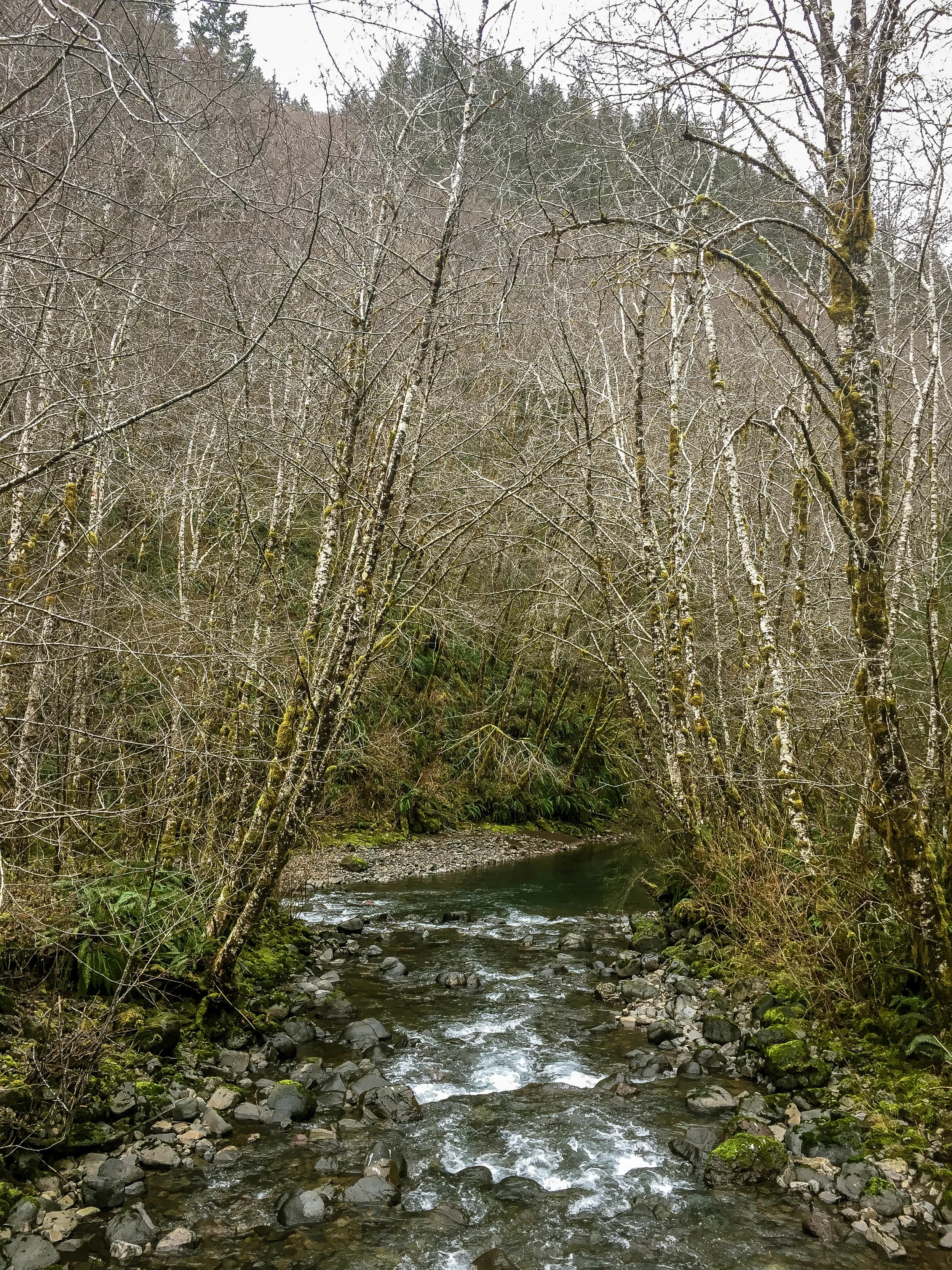
The idea seemed like a relatively straightforward recon. Five experienced riders. 47 miles. Two substantial river valleys with a few gravel climbs connecting the two. Kilchis River up, gravel connectors over the hump and Miami River back down. Kilchis River Road is a sublime example of how ideal winter gravel conditions can be in Western Oregon. Smooth. Fast rolling. Tight. Compacted as if by steamroller. The elevation so gradual it was like we were being drawn upriver effortlessly by some unseen force.
The first eleven miles lulled us into a playful rhythm. This was going to be smooth sailing. Our first taste of things to come was a curious fork in the road. The eye is of course drawn to the much nicer-looking option of continuing painlessly along the river. But no. Our route took us left. Immediately pitching up into a gradient of 15% over loose, sketchy, debris-strewn ruts.


Enamored with the novelty of it, we hammered on, straining to make it from one waterbar to the next. At the first hairpin things got even steeper. Now 20%. The type of incline where you have to strike a balance between a wheelie and spinning out. Then 21%. The next three miles were essentially unrideable, so we pushed forward on the idea that there surely couldn't be THAT much more of this. We could see the light coming through the trees as we neared the top of the ridge, there isn't that much higher we can conceivably climb. But those rationales can be deceptive in the moment. Stopping to rest at the next intersection, it becomes painfully clear that out of the three potential options, our route takes us up the steepest. The idea of turning around is discussed. It is decided push on. We haven't got that far until we reach the top.
Then we run into snow. Impassable. Unrideable. Dispiriting. Deepening snowpack begins to blanket each north and east facing slope. Surely this is only going to be in isolated pockets. Still we push on. Soon the entire road is covered. Every step is an energy-zapping chore, sinking to our knees in places. Every curve and switchback takes us higher, deeper into more treacherous and relentless snowcover. Again, we discuss turning around. To retrace at this stage would be a minor disappointment, but relatively straightforward descent back to Kilchis River. It is decided to push on with the justification that once peaked out at 2700 feet, we will quickly be descending back below the snow line. I register my concern that each step we take is further committing us to the unknown and increasing our likelihood of a much more difficult backtrack.


Still we push on.
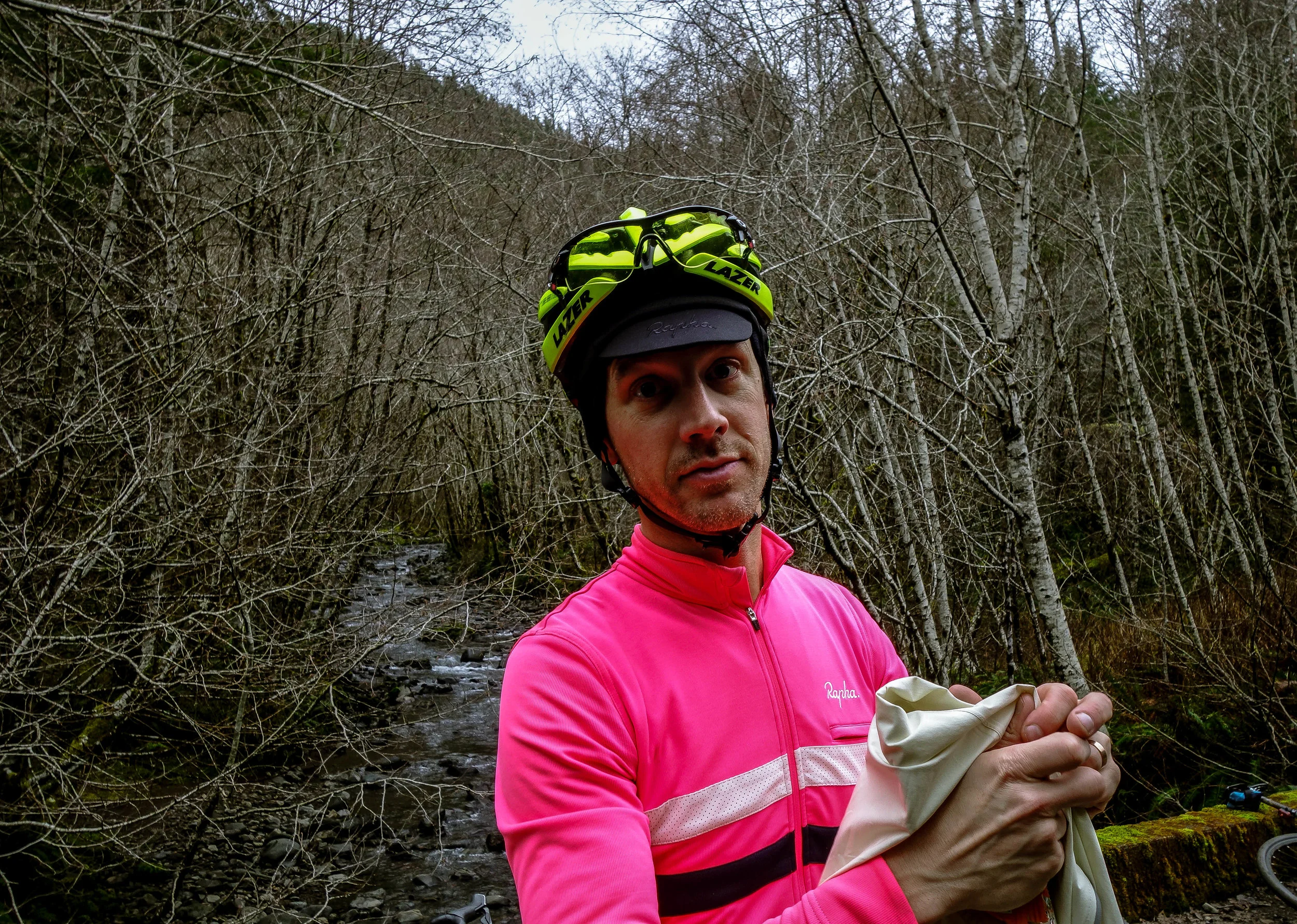
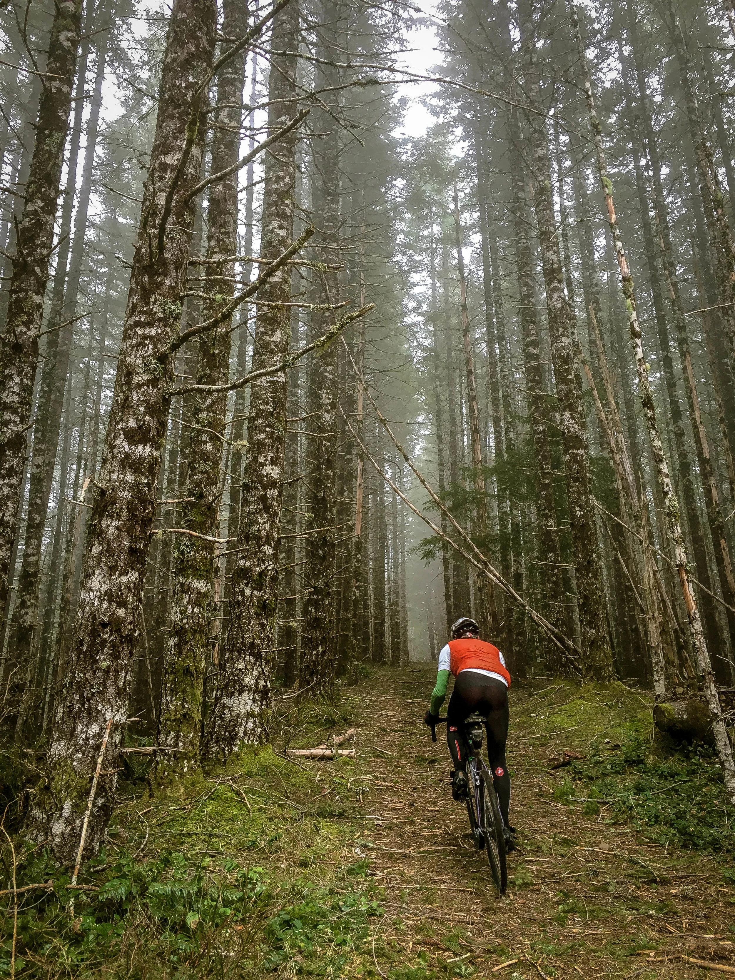
The group stretches out over a quarter mile. Everyone falls silent, doing all they can just to keep going. It is three miles of excruciating snowslog before our gamble pays off and the road dips westward finally clearing enough to ride. We regroup. GPS units confirm we were indeed approaching the top. The temperature seems to have dropped ten degrees as we crest the summit. An icy wind kicks up and it starts to rain. We layer up, don fresh gloves and dive right into a steep descent through sweeping S-curves over new logging roads relieved to be moving again. We are elated to realize that it is literally all downhill from here. Adrenaline is high, feelings are good. There is joking about 'type 2 fun'. This is what it's all about, right? We descend furiously, bunnyhopping debris with cavalier abandon, cooking the corners, snaking along the ridgeline deeper and deeper into the valley below. Down and down and down we descend through the stinging rain spurred on by talk of cold beers and hot food. Down through clearcuts. Down through ravines and valleys and ridges over rocks, ruts, gravel, chunks of earthy rubble. Down two thousand feet in elevation, plunging into dense tree cover. Alpine evergreen gives way to white-barked Alder and deciduous foliage as the road narrows, closing in on itself.
And then it just stops. The road disappears into a dead end.
GPS units are consulted. It certainly looks like the road continues. But there's just a dead end. It just stops. A throb of anxiety hits. It is the middle of January in the Oregon Coast Range. It is 3pm. There is no cell service. Nobody brought lights. Anxiety turns to panic. Legs are cooked. The prospect of retracing the route and climbing back out the way we came is a unthinkable. Our legs are toast at this point. It is certainly an option but not a good one.
"Someone has to know where this goes?? I'm looking for reassurance that this goes through"
A wave of anxiety begins to swell.
"Reassurance? Well - you don't have any"
My mind starts racing. It looked fine on the map. What are our options? How much food do I have left? How much daylight is there? What are we going to do once it gets dark? Nobody has the energy to climb back out of this!
Beyond a barrier of imposing boulders and a gaping pit, the road seems to continue, or rather the vague outline of a former roadbed. An impressionistic tunnel overgrown with thickets, moss and a latticework of fallen trees, long since reclaimed by nature. The road has clearly been decommissioned. Maybe it was planned but never completed. Maybe it was washed out further down. At any rate it certainly isn't rideable nor is there any guarantee that it leads anywhere. It is decided that our best option is to continue hiking down with the hope that it will open back up.


We push on single file over logs, ferns, moss, gullies and creekbeds. Around switchbacks, floodcarved culverts and the eroding remains of waterbars. We round the bend to find a catastrophic washout and what appears to be the Miami River. Like a drunken bulldozer had heaped massive tangles of downed trees and bouldered sediment indiscriminately across the forest floor, we are faced with picking our way though a circuit of sculpted ravines and crumbling channels. Eventually reaching another stretch of roadbed further along, we notice slight evidence of foot traffic. A faint trail begins to emerge along with periodic neon flag strips on certain trees. Someone has been coming up here and they likely didn't come via the direction we did, which means this trail has to lead somewhere. Several river crossings and washout scrambles later, the trail seems to be growing clearer. We begin to notice freshly planted trees with protective chickenwire in what looks like some kind of habitat restoration project. This is a good sign. A very, very good sign.
A monumental wave of relief hits as we catch sight of a gravel road ahead. After a moment of jubilation and relief, we regroup, mount up and begin hammering westward along the Miami River. Back on the grid, so to speak, we are unfazed by the steady drizzle, focused solely on chasing what little daylight we have left. Within sight of pavement we encounter another mammoth sinkhole of collapsed road, a gaping pit nearly thirty feet deep and easily just as wide. Fortunately there is a narrow ledge and we are able to sidestep without too much trouble. The smooth pavement of Miami Foley Road feels like a dream. Asphalt was never such a sight for sore eyes! We tuck into a tight paceline, taking turns pulling each other the remaining 13 miles back to Idaville through Hobsonville and Bay City side roads to close the loop and get into a warm change of clothes.


Most of us have been there in one form or another with varying degrees of consequence. By its very nature, adventure cycling carries a certain amount of implied risk. It's built into the whole idea of exploration. Going deep into the unknown. Pushing against the limits of your comfort zone into the vastness of wild places seemingly indifferent to any particular plan or schedule. The reality is roads sometimes don't go through. There is a lot of trial and error. Online maps oftentimes aren't reflective of current conditions, especially deep in remote areas such as the Coast Range. Now factor in logging operations closing off existing roads, creating spiderwebs of new spurs and massively rearranging the lay of the land and you begin to wonder why anyone would want to do this. The answer is both simple and infinitely complex. The short version is that when it works out, the payoff is incredibly satisfying. There is a certain kind of magic that happens when an area starts to click and successive attempts at configuring a route finally come together with a sense of resolution and deeper understanding of a particular region, its landscape and its individual spectrum of conditions.
A couple of fancy bulleted takeaways and hindsights in no particular order:
- Pay close attention to the elevation profile when mapping. If you start seeing gradients of 15% and higher for anything longer than 1/2 mile it's not really going to be rideable in the up direction. In small doses it will likely be fine, but keep in mind, 15-20% is just as dicey to descend as it is to climb.
- Pay close attention to the max elevation of the route. Does your route max out at 4000 feet? Is it the middle of winter? There is a good chance it's not going to work. Know where the snow line and snowpack levels are relative to your planned route. Know that the temperature is going to drop significantly with any decent amount of climbing. Your 50° day could very easily wind up below freezing at 3500 feet. So find a good system for taking temps as close to where you're actually riding as possible.
- Use satellite view to get a visual on the roads you're planning to ride. If you can't see them they may not actually be there. You can kind of get an intuitive feel for what certain roads are going to be like by zooming in and inspecting them in satellite view. While it's fairly common to have sections dip in and out of tree cover, generally you will want to look closely for visual confirmation of the continuity of the road surface.
- Try Google searching roads you're interested in using. Oftentimes the dual sport moto and off-roading sets are already hip to some of these backcountry gravel areas. You'll be surprised at how helpful GoPro video previews can be for getting a good sense of some of these roads, surface conditions and gradients.
- Think twice about relying on unnamed roads. I know it sounds silly, but I don't put too much stock in roads that don't have names. Particularly in active logging and backcountry areas. Some of them can be fine, but they can often be very dodgy secondary or tertiary roads that peter out unexpectedly. Be careful.
- Stick Together. Common sense stuff but it's easy to have a group get stretched out w/ riders too far ahead or too far behind. It's a good rule of thumb to keep other riders in sight and to stop, wait and regroup at intersections or critical turns. You're only as fast as your slowest rider, so if you're going deep, it can be advantageous to limit your invite list to riders of a similar skill, pace and experience level.