

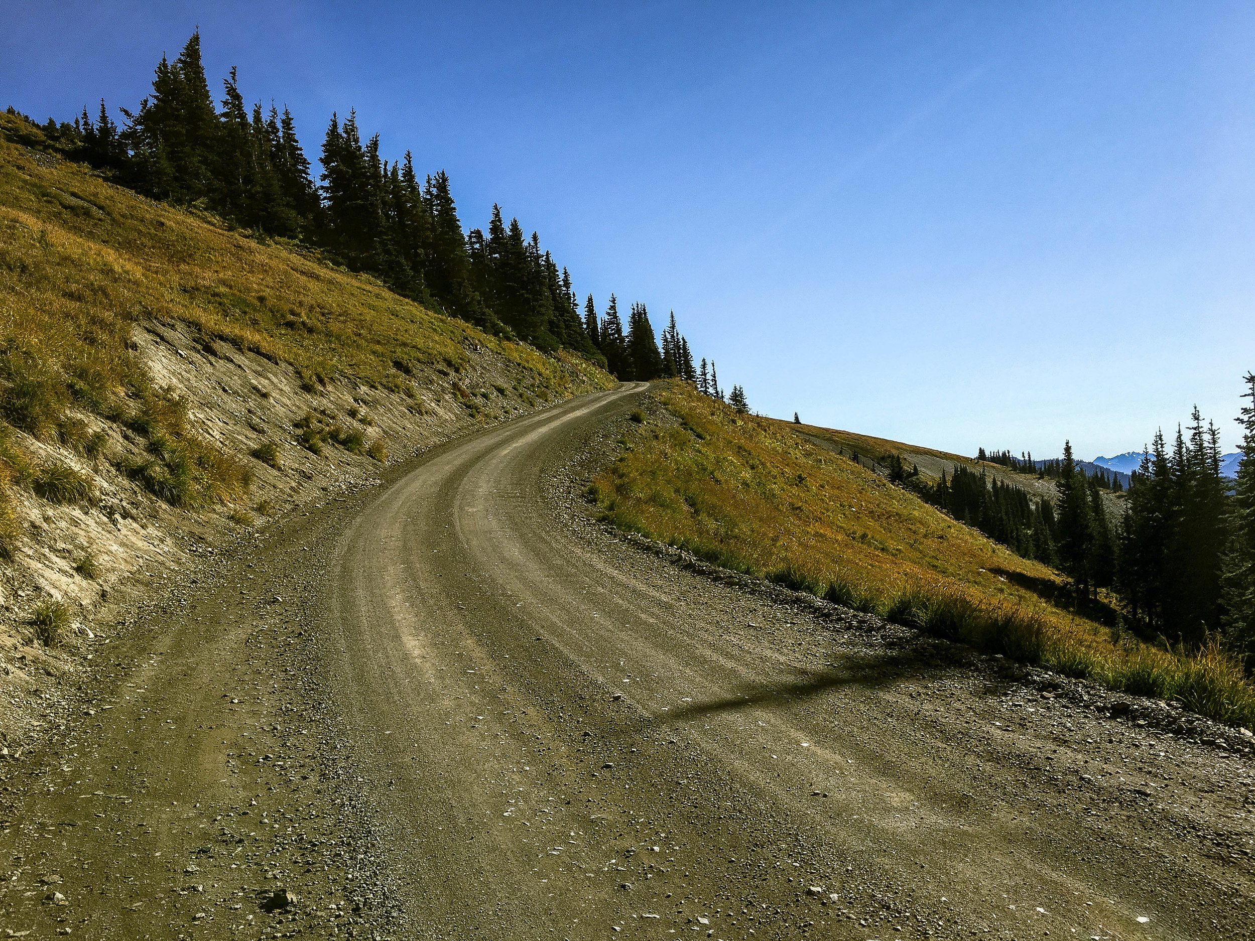
obstruction point might possibly be the most spectacular eight miles in the state of washington. OR MAYBE NOT. washington is a big place. Whatever the case, it's arguably among the top 5 climbs in the pacific northwest. precariously situated along the spine of hurricane ridge, obstruction point snakes eastward beneath steeple rock through dense stands of silver fir, sitka alder and mountain hemlock, in and out of the treeline undulating between golden wildflower meadows and copses of subalpine evergreen.
satisfaction, thy name is obstruction point.

It's easy to pigeonhole Hurricane Ridge as a straightforward weekend warrior out-and-back. It is ostensibly 21 miles of uneventful road climbing from the salty peninsula town of Port Angeles to a high elevation hotdog stand with a gift shop. And most people do just that. Snap a few pictures of some snowy peaks then roll right back down, never bothering with the inconspicuous gravel road at the east end of the parking lot.
And that's okay by us.


Historically the idea was to connect the Elwah River and Deer Park camps over Hurricane Ridge via traversable maintained road. Think CCC era. Think 1930's. It ultimately ended in futility. No big surprise given the scale, density, precipitation and intense seasonality of the Olympic Range. The western portion of the range is dominated by Mount Olympus, which tops out at 7965 feet, a modest height, but nonetheless stands as the most heavily glaciated non-volcanic peak in the contiguous United States...umm, not located in the North Cascades, that is. The Olympic Range isn't exactly huge by Cascadian standards, but it feels impenetrable, difficult, dense and challenging in its own right. Uniquely situated on an isolated peninsula with a wet, rainforested west-side and a much drier eastside rain shadow, the Olympics contain only a handful of high-elevation roads, a couple of which just happen to be fucking spectacular for riding bikes.


What Obstruction Point lacks in continuity, it easily makes up for in gravity, scale and sheer magnitude. Breaking out of the trees around mile 28, a procession of epic reveals rolls out humbling views of Mt. McCartney, Shelter Peak, Mt. Cameron and well, an entire range of dramatically glaciated peaks and lush brooding valleys to the south. Weaving through patchy stands of evergreen, we eventually climb clear of the treeline altogether, still ascending through alternating backdrops of grassy wildflower meadow, saddles of alpine tundra and precipitous basins of crumbed scree.


All of this culminates at the Obstruction Point trailhead (mile 31.4). This will be the jump-off point to Deer Park, Grand Pass, Badger Valley and Elk Mountain hiking trails, but alas the end of the line for bikes due to wilderness restrictions. The irony being that Deer Park and Blue Mountain areas are a mere hop-skip east of Obstruction Point via 7.5 miles of immaculate singletrack, but it is a Federally protected wilderness, so again, this is currently the end of the line. Imagine the incredible looping potential if Obstruction Point-Deer Park trail were open to bikes.
Out-and-back realities aside, this is a great opportunity to make sense of having just climbed 6000 feet in one shot, but more than that, wrapping one's head around the 30 mile, 6000 foot descent that is about to happen. Holy fuck. Get ready! You thought the climb was good?


It's a curious thing how much the character of a road can change by reversing direction. Obstruction Point Road back to Hurricane Ridge unfolds as a series of long velvety smooth screaming descents intercut with climbs that feel three times as pitchy on the way back out. Funny, that. Keep an eye out in the blind corners as this road can see quite a bit of traffic in the high season and several spots along this road have zero margin for error. The final quarter mile back to Hurricane Ridge pitches up into a 10-12% gutpunch, but hey, what's to complain about, you're riding your bike at the top of the world. Only thing left to do is close your eyes and float down 21 miles of gently winding, perfectly graded dream road back into Port Angeles. This descent is so long, you may actually need to stop, stretch and shake your arms out halfway down.
I was just kidding about the 'close your eyes' part.


'Out-and-back' routes get a bad rap. I don't necessarily consider the 'out-and-back' format to be as undesirable as some folks make it out to be. Particularly when there is a significant amount of directional elevation, the look, the feel, the sensation, the experience is going to be entirely different going up than coming down. Not only that, but with an out-and-back, particularly while solo riding, one gets more time to ruminate in a landscape; steep in an area's different moods, progressions of daylight, temperature fluctuations, weather, angles, sightlines, microclimates and shifting perspectives. I feel it can lead to a more thorough understanding having experienced a route in both directions at different times of day under the very different circumstances of climbing versus descending.
59.7 MILES
8813 FEET
ROUTE FORMAT: OUT & BACK
SURFACE: 75% paved, 25% maintained gravel
TIRES: MINIMUM OF 33C. 40C+ RECOMMENDED
BIKE: CYCLOCROSS/GRAVEL/road plus
WATER/SERVICES: hurricane ridge visitor's center/cafe/restrooms/gift shop at mile 21
FULL RIDE WITH GPS ROUTE + GPX FILE
Terms of Use: As with each adventure route guide published on OMTM.CC, should you choose to cycle this route, do so at your own risk. Prior to setting out check current local weather, conditions, and land/road closures. While riding, obey all public and private land use restrictions and rules, carry proper safety and navigational equipment, and of course, follow the #leavenotrace guidelines. The information found herein is simply a planning resource to be used as a point of inspiration in conjunction with your own due-diligence. In spite of the fact that this route, associated GPS track (GPX and maps), and all route guidelines were prepared under diligent research by the specified contributor and/or contributors, the accuracy of such and judgement of the author is not guaranteed. OMTM.CC, its partners, associates, and contributors are in no way liable for personal injury, damage to personal property, or any other such situation that might happen to individual riders cycling or following this route.