Exclusively for RCC members, FARs are epic single-day rides that offer challenge and adventure in equal measure. Fully supported, carefully crafted routes are designed around breathtaking terrain that encourage you to push further, ride harder and reap the well-earned rewards with your RCC clubmates.
rapha sea x omtm | far 02 | rainier | Sat june 7th | packwood wa
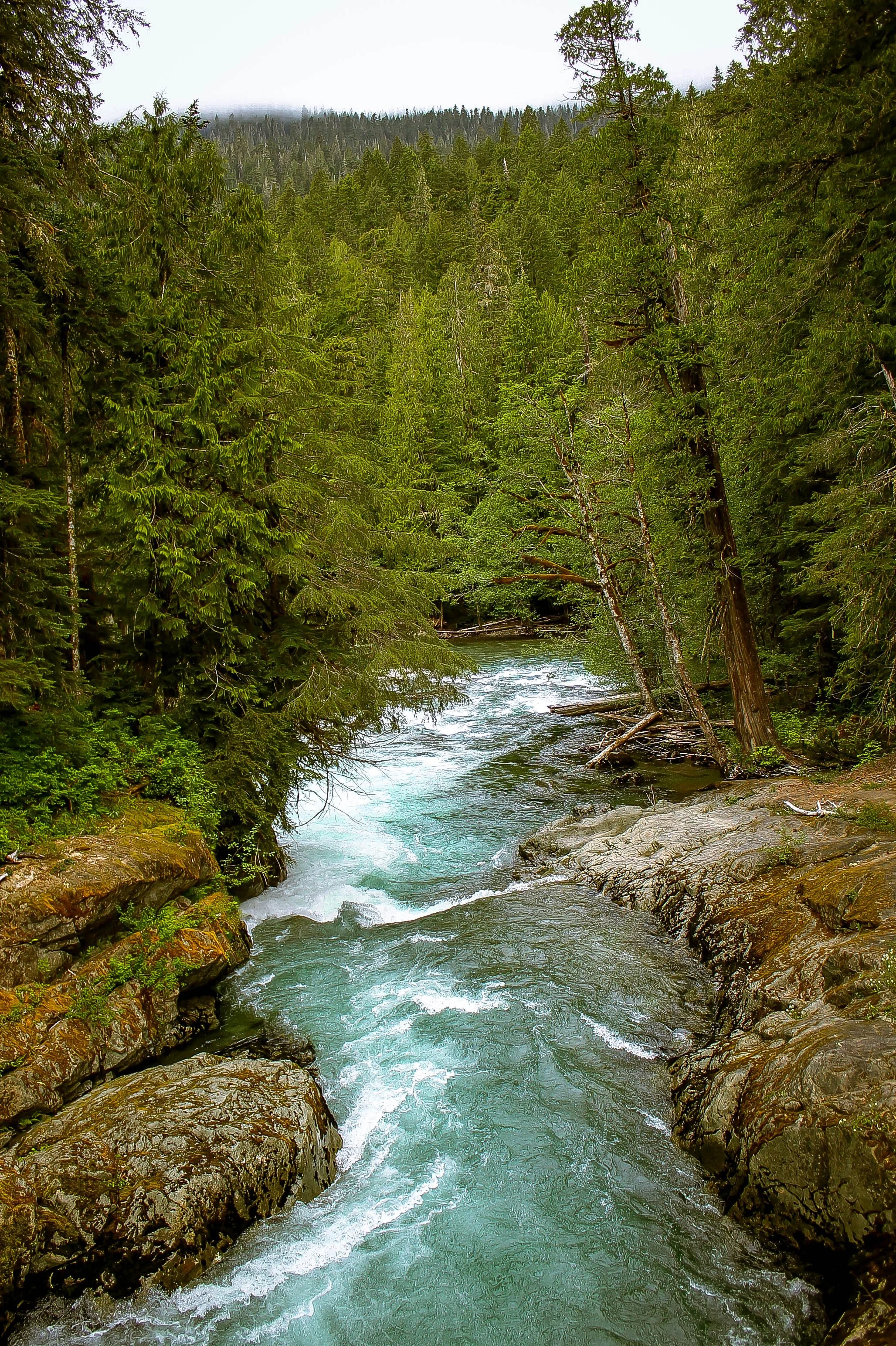
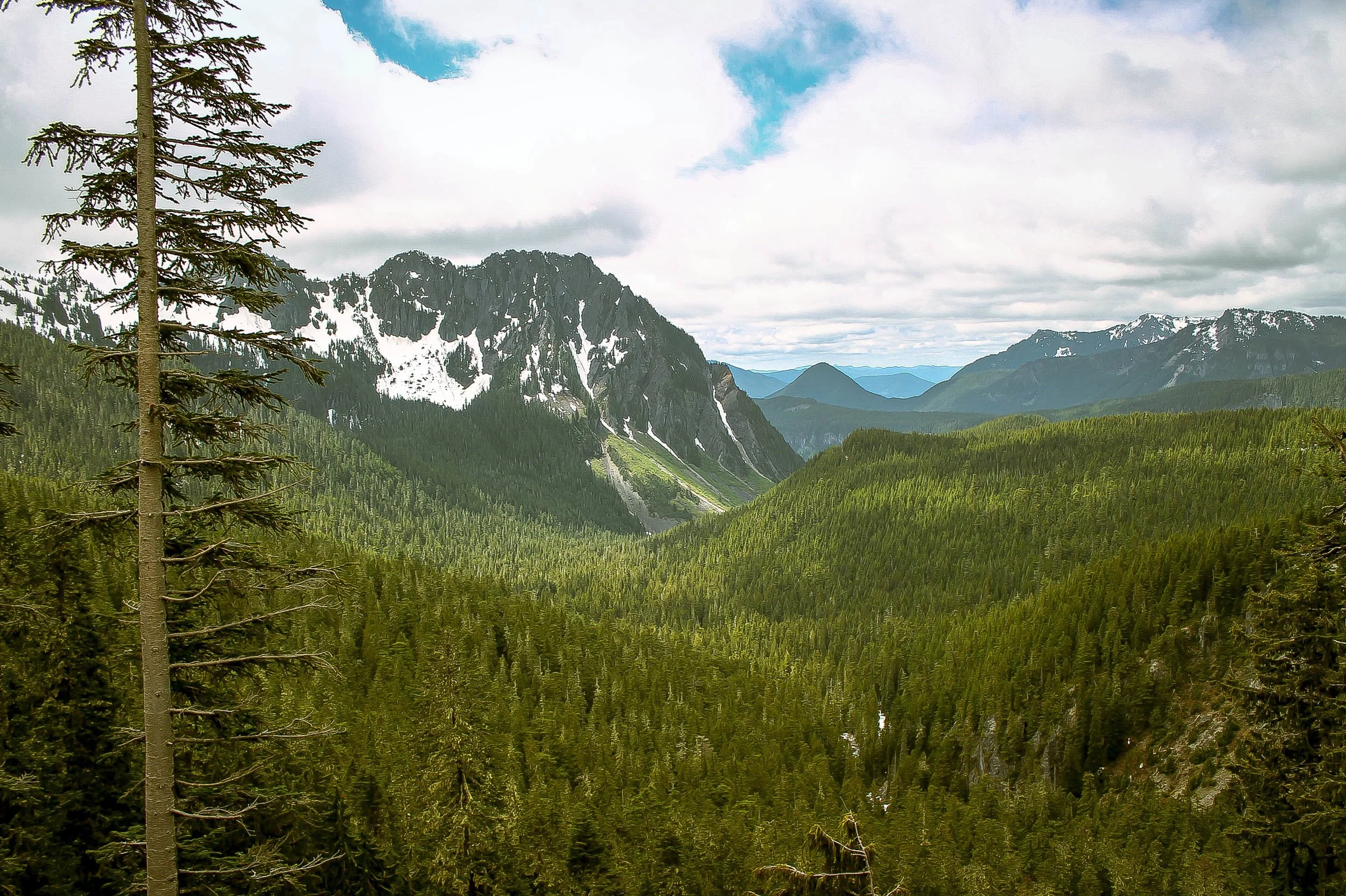
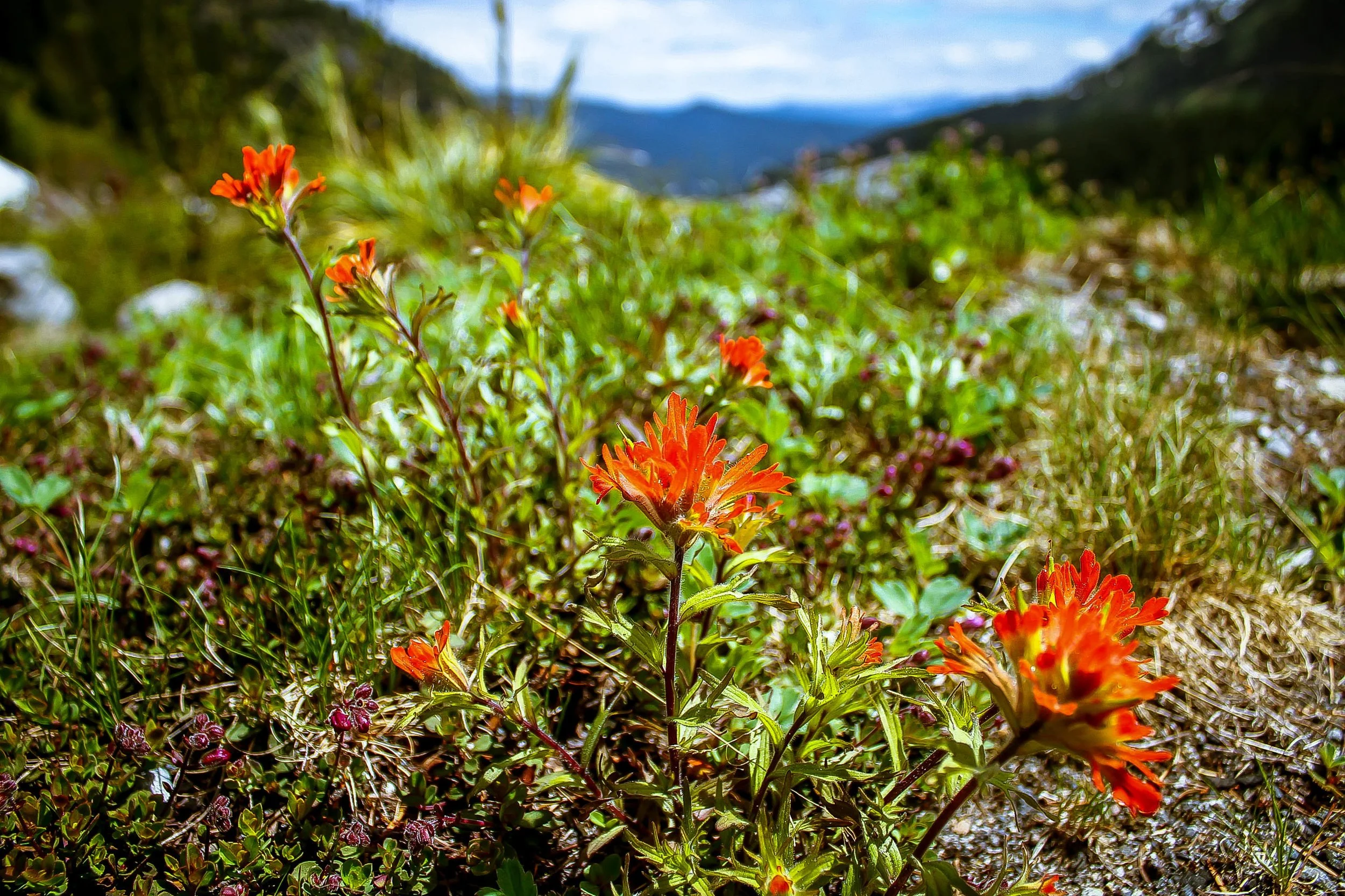
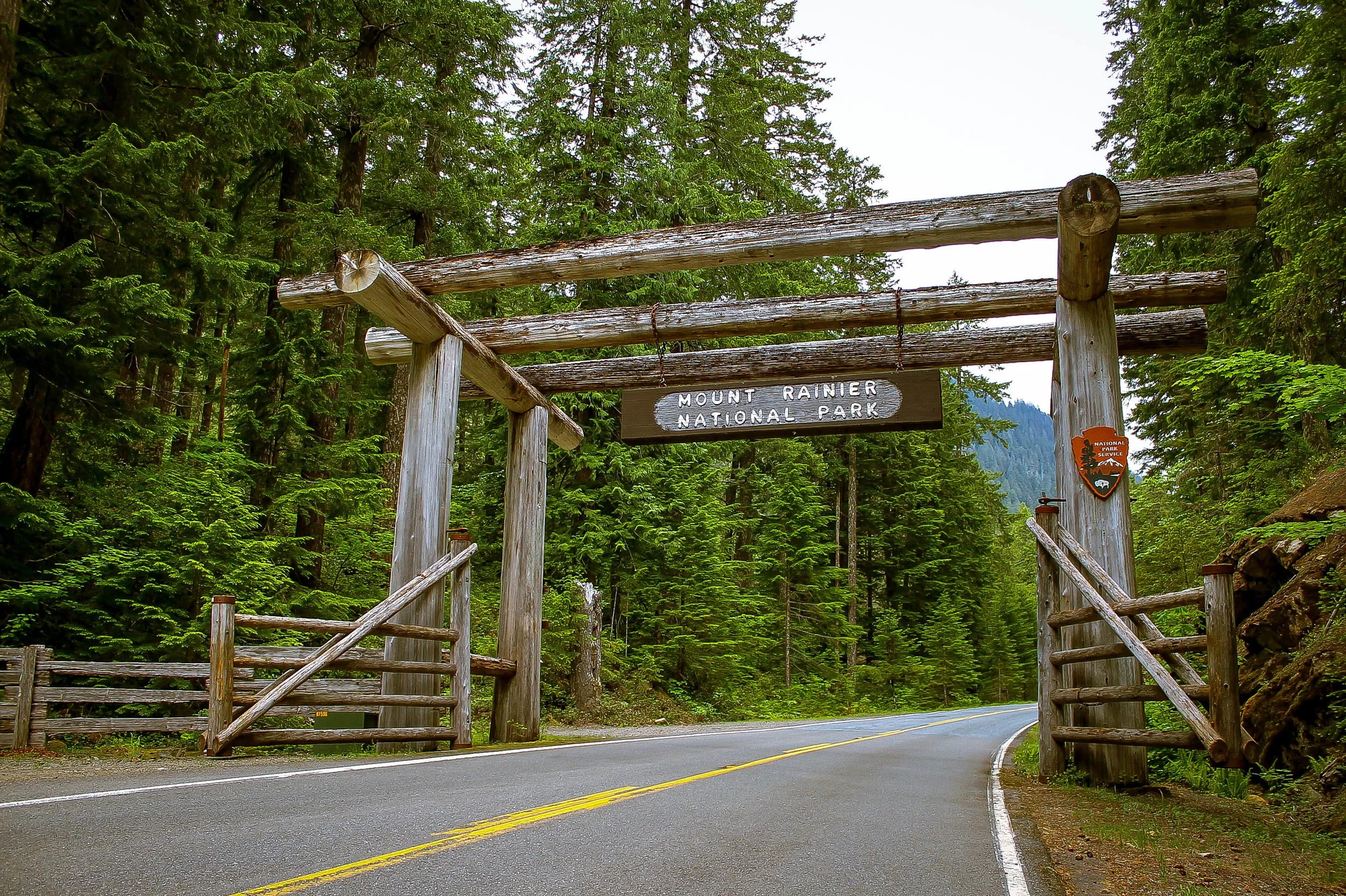
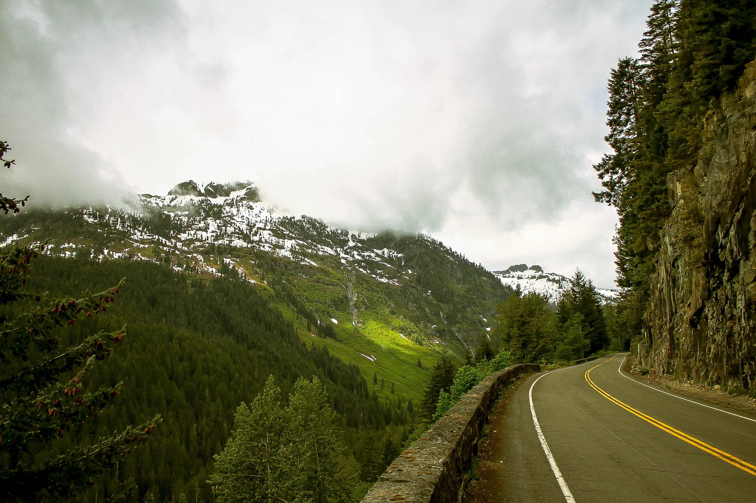
FAR 02 takes us southeast of Seattle to Mt. Rainier and the Tatoosh mountain range, gateway to the expansive and iconic Gifford Pinchot National Forest. Staging in Packwood, FAR 02 will trace the Ohanapecosh River northward, climbing through massive stands of old growth evergreen before entering the Mt. Rainier National Park’s Stevens Canyon entrance. We’ll climb westward into the alpine expanse of Stevens Canyon amid jagged, snowcapped peaks and wildflower meadows rushing with meltwater. We continue to climb along high cliff walls, skirting sheer drops, epic alpine switchbacks and mountain lakes, passing beneath overhanging ledges weeping with hundreds of seasonal waterfalls. The proliferation of available water in the spring and early summer is incredible. We highly recommend bringing a water filter to refill at any number of these fantastic sources.
There is an optional stop at the Paradise visitors center where riders will find food, water refill, restrooms and additional services. From Paradise, the route heads sharply downward for about 12 miles of absolutely epic alpine descending to Longmire. Here the two routes will diverge, the longer option continues out and back to the Westside Road climb and the shorter version simply turns off at Longmire. Both variants utilize the Longmire side door, crossing the Nisqually suspension bridge to exit the park to Skate Creek. The final segment along Skate Creek is a gentle, sublime, deeply shaded rolling descent back to Packwood through the edge of the Gifford Pinchot National Forest.


Below is a little more detail about the day’s schedule, route options and descriptions, equipment guidelines, logistics for the day, and a bit about what you can expect by way of support.
The Schedule
8:00am-8:30am | ARRIVE | Meet up at Packwood Community Park (location marked within the routes)
8:30am | PRE-RIDE MEETING | Review the route (see below), introductions, and head out.
8:40 | DEPART |
5pm | ESTIMATED FINISH |
5-9pm | POST-RIDE HANGS | Packwood Brewing. First drink + food is on Rapha.
The full routes are 62 and 95 miles. Expect the ride to take between 5 - 7 hours + stoppage time. Post-ride food and drinks at Packwood Brewing, compliments of Rapha Seattle, for those that complete the full route. Details below.
FAR 02: RAINIER ROUTES
Please download and sync routes to your head unit the night before the ride and arrive with the routes downloaded and ready to roll. If you’re on the fence about which route to choose, consider that the Westside Climb version includes an additional 13 mile, 1200 foot backcountry gravel section in addition to the standard Skate Creek loop. We don’t recommend anything smaller than 32c-35c gravel tires for the Westside variation. Robust slicks, semi-slicks or light knobbies are recommended. Please plan accordingly and come prepared with spare tubes, tools and weather/condition-appropriate gear.
FAR 02: RAINIER | STEVENS CANYON TO SKATE CREEK
61.2 miles | 5794 feet
96% paved | 4% smooth gravel
Road or all-road bike w/ 32c - 38c optimal
FAR 02: RAINIER | STEVENS CANYON TO westside climb
96.6 miles | 9690 feet
80% paved | 20% gravel
all-road or gravel bike w/ 40c – 50c optimal
Ride Guides
There are two route options for the day. The key distinction being that one includes an optional out-and-back gravel climb up Westside Road.
The standard Stevens Canyon loop is 62 miles with 5794 feet of elevation and is rideable on a well-maintained road bike with 700x28c tires. Because of the bumpy nature of some of the roads, 32-35c is optimal, but 28’s will work. Why 32-35? Because Stevens Canyon has some pockmarked pavement, gravel sections and fairly large open gratings that can be sketchy on 28c.
The Stevens Canyon loop w/ optional Westside Road climb is 96.6 miles with 9690 feet of elevation gain and is rideable on a well-maintained all-road or gravel bike with 40c plus all-road or gravel tires. The first 46 miles are identical for both routes, so bailing out is super easy if plans change over the course of the day.
Both routes use Longmire to exit the park, just at different points within the ride. The exit is not immediately intuitive. Pay close attention to the route trackline which climbs through the ranger staff housing area to cross the Nisqually suspension bridge, exiting the park through the Longmire Stewardship Campground area. There will be a locked gate and a 1/3 mile gravel section before intersecting Skate Creek Road.
Park entry is $15 per person for riders entering by bicycle. The pass is good for 7 days. We would highly encourage riders to pre-purchase their entry passes via the NPS (National Park Service) app or Recreation.gov account. This will significantly streamline park entry for the group on Saturday. Riders paying w/ cards may consider buddying up and covering a ridemate or two, again, in interest of expediting entry into the park.
Support stops: these are marked with the red A icons in the route.
The first will be at Box Canyon parking pullout.
The second – and more robust lunch stop will be up near the Paradise picnic area pullout. The full picnic area is still under plenty of snow, so we’ll be tucked in behind the barricades. The Paradise Visitor’s Center will be just up the hill from this support stop, with restrooms, additional food and water should riders desire.
The third will be for long route riders only and will be stationed at the bottom of the Westside Road gravel climb with the intention of providing support after coming back down the Westside Road descent en route to Longmire.
There will be an additional floater station outside the park as the gravel section of Forest Road 012 intersects Skate Creek Road en route to Packwood.
All gravel sections are marked in blue. The long route will obviously have a long gravel climb + descent, but the short route has a few brief gravel sections as well, which are all smooth road bike accessible maintained gravel. The Westside Road climb is incredibly gentle as far as unpaved roads go. It never exceeds 5% grade and is surfaced almost entirely of smooth-rolling hardpacked dirt with scattered sections of loose pea gravel. You will not need knobbies here. Comfortable 32-40c road slicks will do fine.
Long route riders will want to be absolutely sure to bring lights. This is not because we expect riders to be finishing in the dark, rather because the final 13 miles along Skate Creek Road are very potholed and patchy with intermittent gravel sections. Skate Creek Road is deep in a shady valley that gets dark earlier than the surrounding areas. Untimely mechanicals, long lunch stops or unforseen delays can push riders into a dusky finish, so be sure to bring a headlight.


Stevens Canyon is absolutely the crown jewel of the Rainier experience. Designed in the 'rustic style' utilizing classic stone bridges, tunnels, viaducts and retaining walls of 1930’s National Park architecture, Stevens Canyon Highway was not completed until 1957. Climbing east from the Ohanapecosh River, the Grove of the Patriarchs contains some of the largest stands of old growth Douglas fir, hemlock and cedar in the Cascades. Riders get a little tease of things to come at Backbone Ridge with a spectacular glimpse of the Tatoosh Range to the south and east. The proliferation of snowmelt runoff waterfalls in the spring and early summer is incredible. We highly recommend bringing a water filter to refill at any number of these fantastic sources.
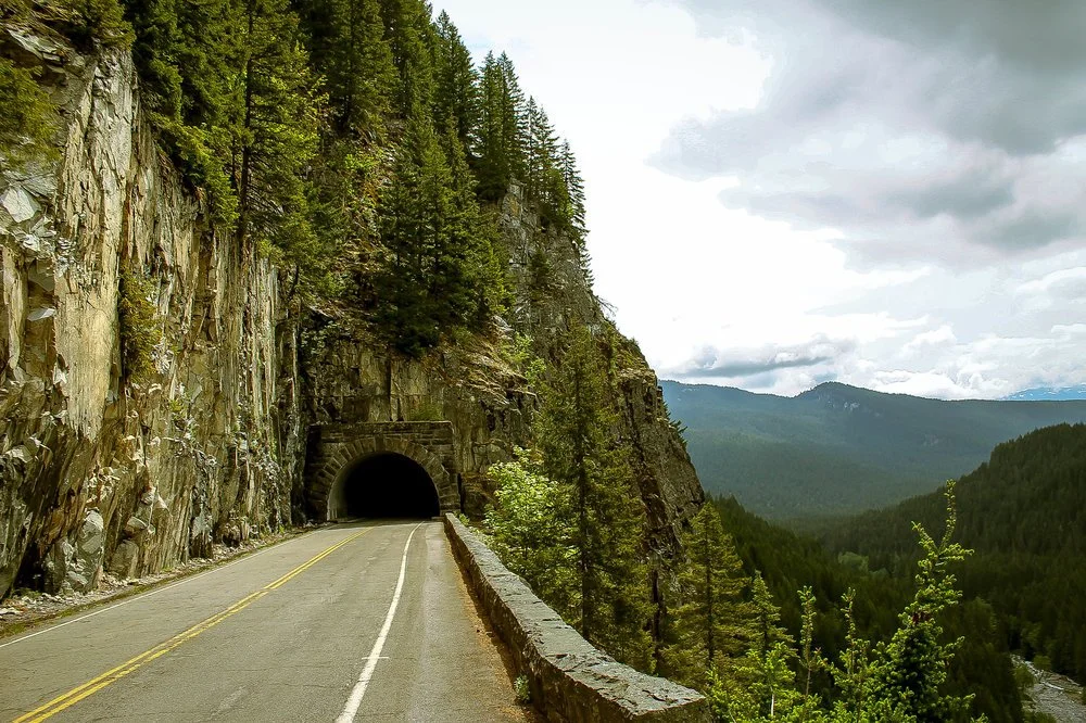
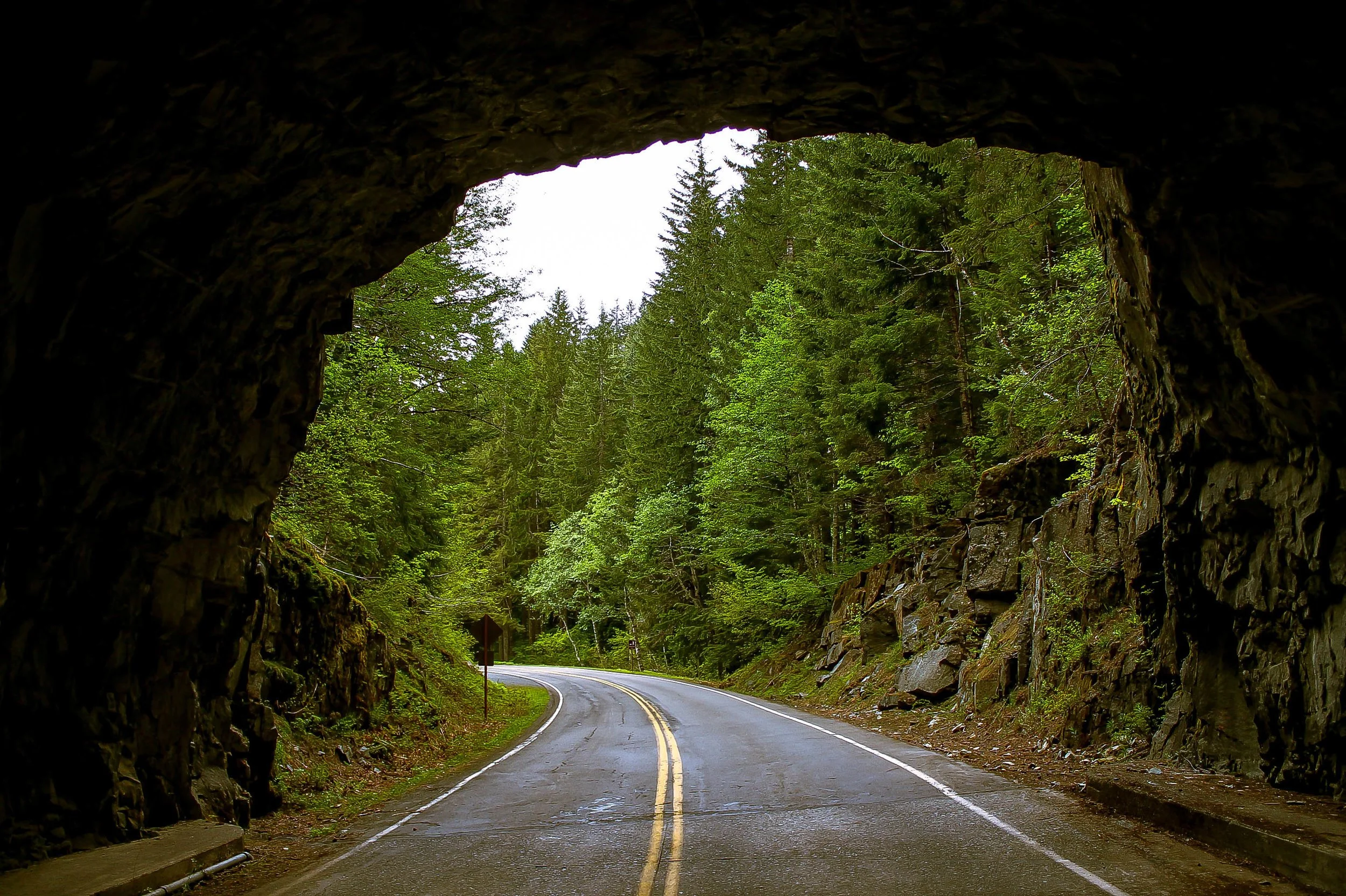
At Backbone Ridge the climb slackens for a short descent into Box Canyon. Hundreds of thousands of years of runoff from the Cowlitz Glacier has carved this 180 foot deep, 13 foot wide chasm into the andosite bedrock. The Cowlitz and Ohanapecosh Rivers share the unique distinction of being the only two catchments in the park flowing into the Columbia River rather than the Puget Sound. From Box Canyon the climb resumes through one of several roughly hewn rocky tunnels upward into Stevens Canyon.
As the road arcs westward we are plunged headlong into the wide open expanse of Stevens Canyon and the jagged peaks and high alpine meadows of the Tatoosh Range. The ascent intensifies, winding west along high cliff walls, skirting sheer drops, passing beneath overhanging ledges weeping with hundreds of seasonal waterfalls. The views compound around every bend, each impossibly epic sightline topping those previous.
You were promised amazement and Stevens Canyon delivers.
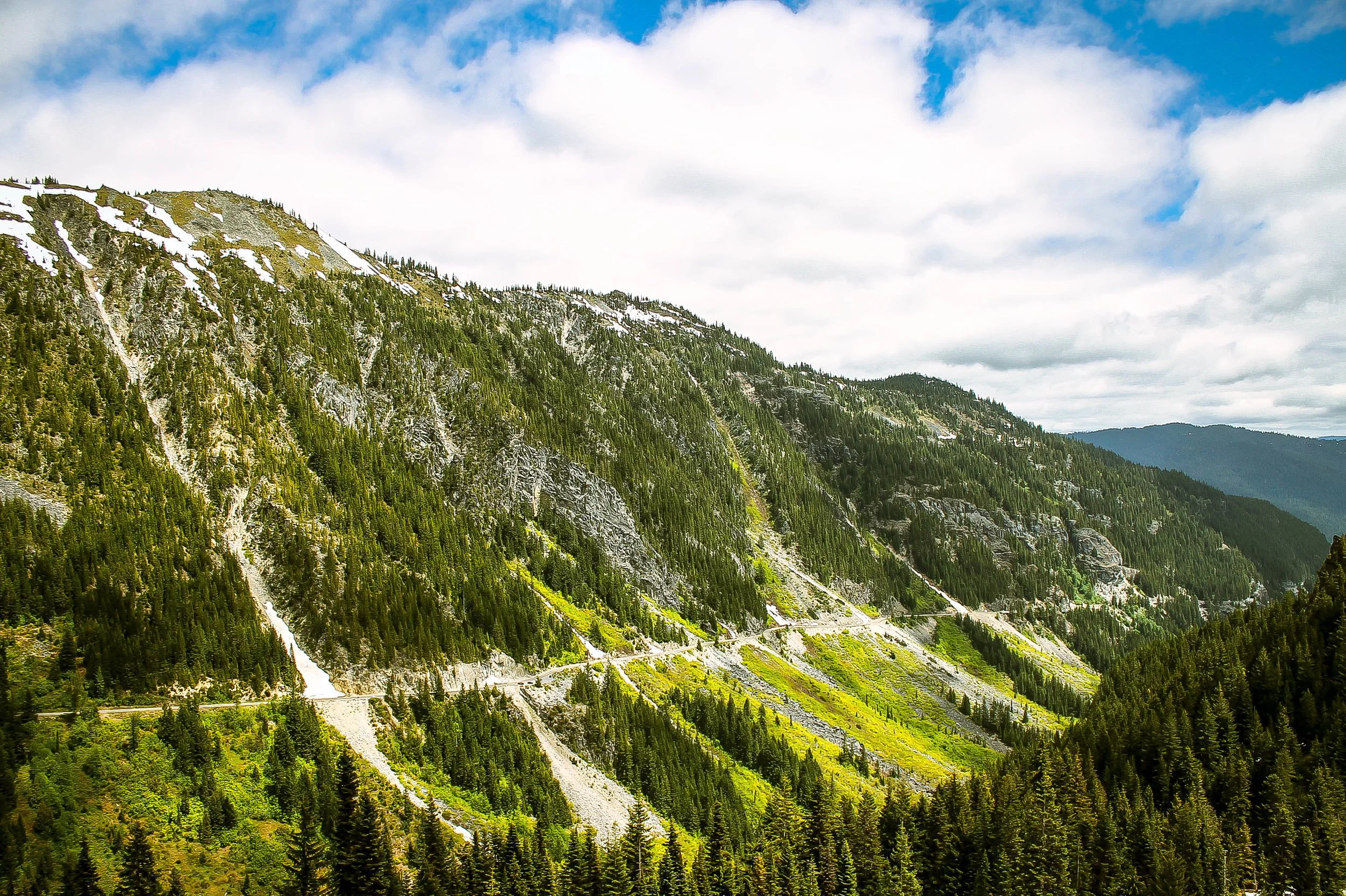
Rounding the bend over Stevens Creek, the road curves southward and begins to climb out of the valley up the switchbacks toward Bench Lake and Unicorn Peak. The iconic switchbacks rise roughly 1000 feet over three miles evoking the classic European cols of the Alps and Dolomites. Winding upward, the staggering views of the glaciated valley below reveal the magnitude of the climb. The elevation begins to abate approaching a series of high alpine lakes. The stretch between the reflection lakes and Paradise is very popular with tourists and will have a fair amount of traffic in the high season. That said, the monumental sightlines from Inspiration Point of the Tatoosh peaks westward is undoubtedly one of the highlights of the route.
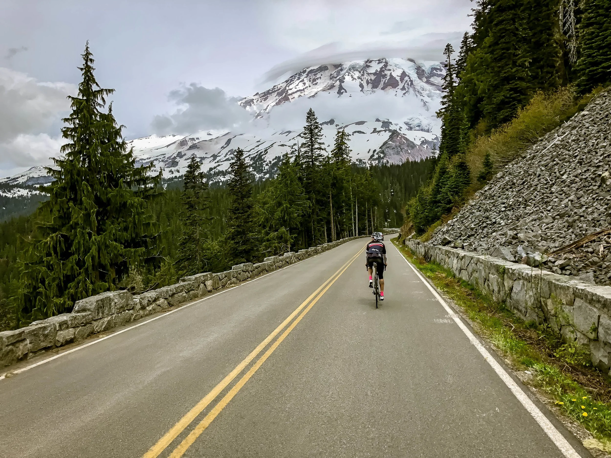
Paradise Road East is a descent of dreams. Sweeping S-curves, tight cornering, pristine asphalt, it's all here. At mile 38.8 in the loop version of the route there will be a small optional loop to Ricksecker Point with mindblowing views of the Nisqually River Valley, Wilson and Nisqually Glaciers and a full-frontal of Rainier in all of it glory.
Descending along the north bank of the mighty Nisqually River, Paradise Road East sweeps gently though dense shady stands of Douglas fir and velvety moss before cutting left through the Park Service admin buildings at Longmire. Riders will cross the Nisqually River and continue south through the campground complex to intersect Skate Creek Road. Skate Creek is a nice, shady departure from the traffic and bustle of the park. It quietly rolls back to Packwood through dense Gifford greenery between the debris-ravaged Nisqually and lush tranquility of Skate Creek.


RIDE SUPPORT
Rapha will be set up at the following positions along the route with Hydration & Snacks:
23.8 MI - Hydration Station - Box Canyon Picnic Area - turnout on left side of road.
33.5 MI - Paradise Picnic Area - Hydration, Food/Lunch, Restrooms
52MI/72MI - Hydration Station @ Base of Westside road/climb.
There is also a self-supported stop along the route for water, restrooms and food at the Paradise Visitor’s Center noted in the Ride With GPS File.
NOTE: If you know you will do better with specific ride food, please feel free to bring that with you for the day.
PARKING & MEETUP
We will be meeting up at within the Packwood Community Park behind the Packwood Community Hall and Senior Center. There will be limited parking within the park itself, but enough for 10-15 cars. Do not park in the lot in front of the Community Hall + Senior Center. Packwood has plenty of open parallel and front-in parking along the main street in town, so overflow folks will have plenty of options adjacent to the start.
Social engagement
Friday evening: 6-8pm we’ll be hanging at Packwood Brewing so folks can meet and greet.
Saturday evening: 5-9pm. Post-ride dinner at Packwood Brewing. First drink + food will be on Rapha. Note that the kitchen closes at 7:45pm, so if you’re intending to eat, you’ll need to arrive and order prior to 7:45.
packwood dining & lodging
food
Packwood Brewing Co.
Family-friendly brewery offering a seasonally rotating menu with tacos, nachos, quesadillas and bowls. Meat and veggie options galore. Enjoy their craft beers in a cozy setting with outdoor fire pits. Rustic yet refined.
Blue Spruce Bar and Grill
Local dive bar known for its fried chicken, burgers, and late-night hours. Features pool tables and a casual atmosphere.
Cliff Droppers
Specializes in hearty burgers, including elk and salmon options. A go-to spot for filling meals after outdoor adventures.
Cruisers Pizza
The town’s dedicated pizza joint, offering comfort food favorites in a relaxed environment.
White Pass Taqueria + Taproom
Serves Tex-Mex dishes like tacos and burritos, complemented by a selection of craft beers. Enjoy mountain views from their beer garden.
The Mountain Goat
Packwood’s only bakery and café, providing espresso drinks and a variety of pastries to start your day.
Zest Srithai Food Truck
A weekend-only food truck serving Thai cuisine, praised for its flavorful dishes.
lodging
Packwood Lodge & Cabins
Newly renovated lodge offering luxurious suites and guest rooms with modern amenities. Located near Mount Rainier National Park.
Historic Hotel Packwood
A boutique hotel with nine uniquely decorated rooms, featuring luxury bedding and vintage charm. Centrally located in downtown Packwood.
Cowlitz River Lodge
Offers updated rooms equipped with refrigerators, microwaves, and Keurig coffee makers. Guests often spot elk on the property.
Crest Trail Lodge
Provides clean and comfortable accommodations with easy access to White Pass Ski Resort and Mount Rainier.
Packwood Inn
Under new ownership since 2018, this inn features renovated rooms and a rustic retreat ambiance.
Vacation Rentals
Options like the “Gnome Home” and “Packwood Ski & Vacation Getaway” offer private accommodations with amenities such as hot tubs and fully equipped kitchens.