
the Swale canyon 80 loop is a fresh riff on longstanding classics. drawing from highlights of both the dalles mountain 60 and its mutinous spinoff, we sought to reimagine familiar environs as a multifaceted adventure featuring a mix of rambling gravel, sweeping singletrack, classic vistas, epic descents, quiet canyons and seldom-ridden railroad grades.

Dalles Mountain 60. We all know it. We’ve all loved it. We’ve all hated it. We’ve all cursed the blustering headwinds and helldriven rain. We’ve all cracked summit beers and sour worms, giddy at the expanse of it all, the sun punching glorious rays between stormclouds. VeloDirt’s storied ‘ride that started it all’ has more than earned its reputation as a calendar staple, but at 60 miles and 30% dirt, the original feels quite tame by 2019 standards. Over time, a rogue DM ‘Mutiny’ loop developed as a loose separatist excursion. An overnight interpretation, mutiny riders sometimes start with the main group, splitting off at the Dalles Mountain summit to follow the Klickitat Trail. While both of these routes are fun with unique senses of character and some great reveals, ultimately both begin to suffer midway from slog syndrome: too much of the same thing for too long.


So we set about to create the Swale Canyon 80, paying homage to the originals while adding in several new elements to put a fresh spin on the experience. For our approach we opt to sidestep lower Dalles Mountain Road in favor of the lesser-traveled Vista Loop through Columbia Hills State Park, which climbs beneath cascading waterfalls amid drainages filled with garry oak and stands of legacy timber dating to the homestead era. The first thing you will notice is that approaching Dalles Mountain from this angle has an entirely different feel, much more intimate, secluded and wild. Rambling through lazy doubletrack, the trail, at times, nothing more than a faint impression through the grass, a sensation akin to wandering the backacres of a former ranch, which is precisely what it is. The trails are simple, understated and wonderful, meandering the folds and foothills, evoking bluffs of the Scottish seaside.


There are a few options for navigating the Columbia Hills to connect with Dalles Mountain Road. The lower Vista Loop trail counterclockwise will be the most scenic and gradual, eventually intercepting Dalles Mountain Road just shy of mile 14. The next 4 miles climb upper Dalles Mountain to the radio towers where we are presented with two options north to the Centerville Highway. O’Brien is a poorly-draining primitive road with insidiously muddy ruts and standing water on a good day and is all but impassible when wet. We prefer Uecker Road for two reasons, the first being the absolutely ripping descent down the backside of Dalles Mountain and the simple fact that Uecker is smooth, quick and easy under just about any conditions.


In this orientation, the Klickitat Trail officially picks up at the intersection of Uecker Road and Centerville Hwy, however we recommend bypassing the overgrown chunkybits on the east end in favor of entry into Swale Canyon via Harms Road. For the uninitiated, the Klickitat Trail is a 31 mile rails-to-trails byway following the former Burlington Northern Railroad corridor that linked Lyle and Goldendale.
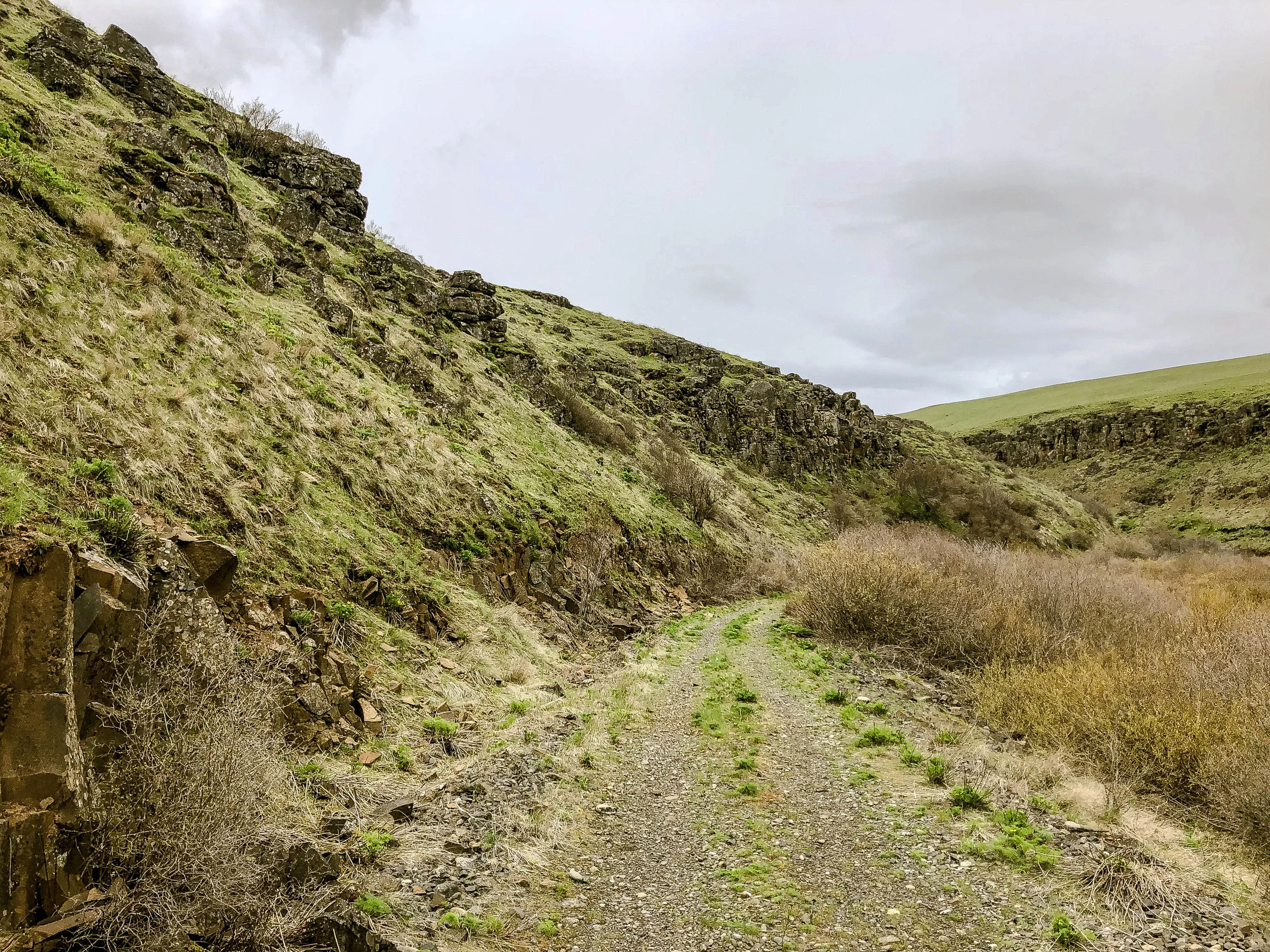
The trail follows Swale Creek through 11 miles of rugged and rocky tributary canyon. Think of it as a window into a the old West; a slightly more-remote companion piece to the Deschutes River Trail, albeit one that actually goes somewhere. Expect a fair amount of chunky rock, rubble and primitive trailbed through Swale Canyon. The functional end of the trail comes at Wahkiacus, however the trail continues to a dead end another 2 miles along the south side of the river to crumbling buttresses of the old railroad trestle, passing the remnants of the Klickitat mineral springs, across from the former Gas-Ice Corporation’s iconic dry ice building.
*Please be aware that Swale Canyon typically closes from July 1 - October 1 due to dry conditions and fire danger. Signs will be posted on entry gates.
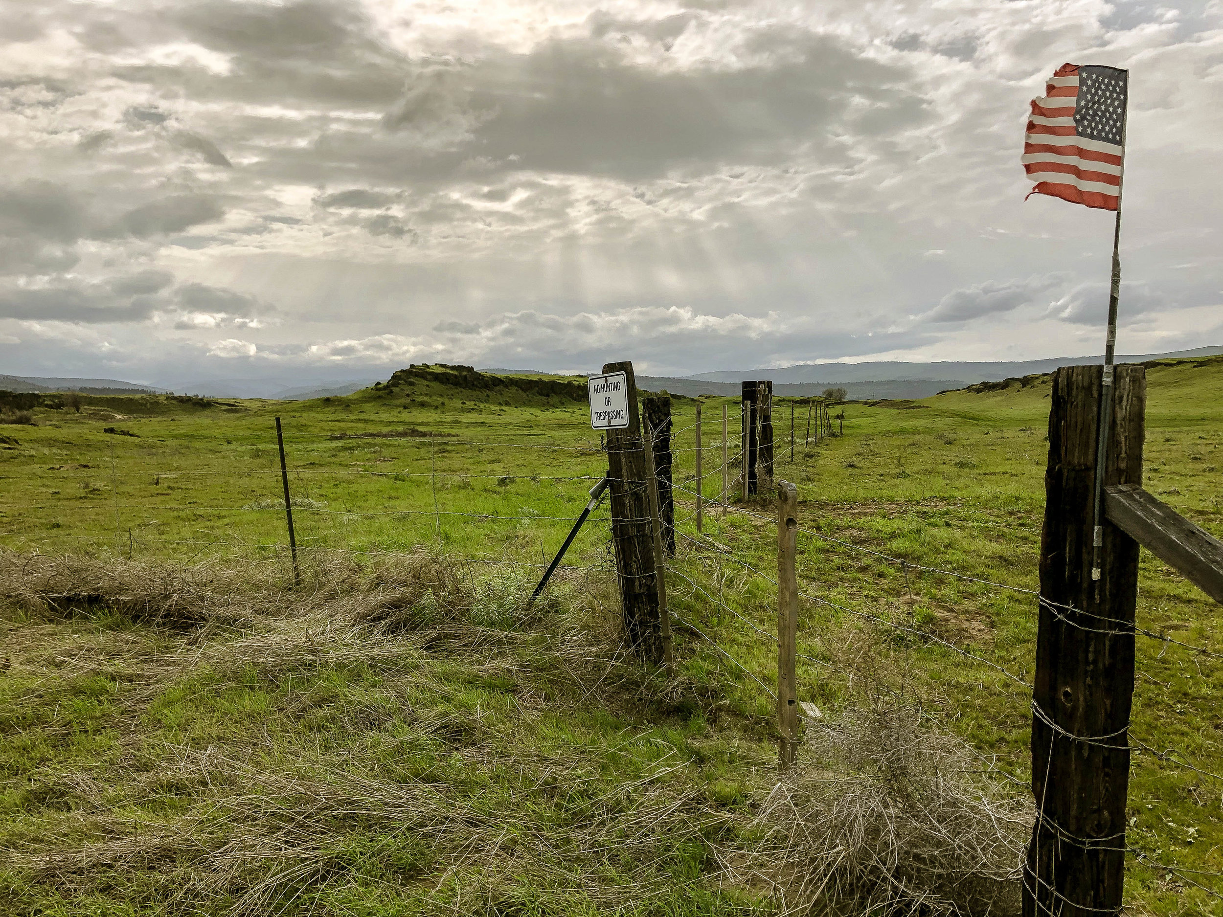
*Also be aware that the Klickitat trail has a controversial history and hasn't been accepted by everyone in the community. Leave No Trace practices are vital here - pack out all trash and stay on the trail. Though the trail is public access, most of the land on either side is private. There are multiple gates across the trail but none will be locked. Simply pass through and secure the gates behind you.
*Also be aware that this is ‘goathead’ country. Running tubeless tires is highly recommended as the thorns of tribulus terrestris will most likely puncture 12 out of 10 tubes whenst riding off the beaten path in the central OR/WA Columbia high desert region.


If you’e not yet hip to the untapped sublimity of the Appleton highlands, you’re in for a treat. We find it hard to resist the hill country between two Wild and Scenic Rivers. The end of Swale Canyon marks the closing of one chapter and the beginning of quite another as we pitch upward into the next phase of the route via Wahkiacus Heights. The tarmac climb is a welcome reprieve from the bob-n-jostle of the canyon, ascending sharply to overlook the valley below, gaining around 1200 feet before returning to the gentle gravel rollers of Long and Brewer roads. The quiet, sparsely-populated highlands between Wahkiacus and Appleton roll in and out of fragrant pines, copses of craggy oak and bunchgrass en route to the premium Cadillac butter of Fisher Hill, which begins trending downward around mile 51, the next 10 miles worth every pedalstroke thus far!


At the risk of underselling the Fisher Hill descent, a look at the map view is all you need to know. It is the proverbial gold stretching from the middle to the end of the Appleton rainbow, snaking back on itself through five dramatic, ultraphotogenic switchbacks with sightlines across to Mt. Hood. Though the visuals are slightly ridiculous, the declivity is actually quite gentle, descending smoothly back into the Klickitat River gorge. As the Klickitat approaches the Columbia, the canyon tightens and small rapids spike the channel, dropping into a tight, rock-walled gorge. The water cascades and crashes through rocky channels where the Yakama Nation has used dip-net fishing continuously for generations to catch salmon and steelhead.

Terminating at the Lyle trailhead, the Klickitat portion of the loop gives way to an entirely new kind of adventure: Highway miles! Everyone’s favorite! To be clear, Highway 14 is fucking awful but necessary. It is busy, harrowing and tight with little-to-no shoulder in many spots. It is ripe with highway-speed traffic, angry trucks, sketchy suicide tunnels and is somehow still the only option for connecting certain points along the Washington side. Luckily, in this case we’ve only got 5 relatively forgiving miles eastward along 14 with a single short tunnel. Be aware the tunnels on 14 have no bike lane, no sidewalk, no lighting and no guarantees. They are sketchy as fuck for bikes, so be very alert. I have found it helpful to either wait for traffic to subside completely or even better, a sympathetic eastbound motorist slows down, waves you through and effectively provides cover for your safe passage.


With that bit thankfully out of the way, around mile 68 you will notice a frontage road taking shape down to the right between the railroad tracks and the river. There will be two ideal points of access, the first is a semi-legit/semi-trespassy gate-hop which drops directly down to cross the tracks. The second is through the adjacent neighborhood immediately to the east via River View Drive. Either way, we’re a bit ¯\_(ツ)_/¯ on the subject of public access to this end of the frontage road…we’re not tellin’ you to ride it, we’re merely pointing out that it is there.

Our journey forward from here is part cutty access road, part industrial ossuary and part anarchy badland skirting the periphery of Dallesport along the river. Amid the remains of rusting machinery, bonfire debris, ramshackle fishing camps and burned-out RVs, this sandy strip takes on the name Old Ferry Road before crossing the tracks, returning to the pavement of Dallesport Road en route to the Dalles Bridge. For those inclined, there are still a few intertwining bits of rogue stumbletrack and sandy dirtpath leading back to the bridge, but at this stage we imagine most folks may have gotten their fill of the rough stuff. Back on the Oregon side, we much prefer the Old Dufur/Brewery Grade high road to slogging Highway 30 back into (and out of) The Dalles, but different horses for different courses as they say.


ALTERNATE VERSION
If at the end of Swale Canyon riders should find themselves in need of supplies, water, snacks, super glue, heatlamp pizza or tallboys of magic lager, the town of Klickitat is just a handful of miles east along 142 with an easy climb to return to the route via Klickitat-Appleton Road, which provides some stellar vistas. Aside from the resupply, the added curiosity of this version will be the abandoned J. Neils lumber mill which operated from 1922 to 1994 and has existed in various states of decay ever since. The mill grounds are gated and signed as private property and I’m pretty sure it’s haunted by at least seven malevolent ghosts. Again, we’re not telling anyone to trespass, simply pointing out that it is there. I will add though that it is nine-kinds of sketchy and pretty creepy-cool. Just sayin’…


swale Canyon: LYLE START
This version has quickly been adopted as the new standard, keeping everything tidily on the Washington side of the river. This variant stages up and finishes conveniently at the Klickitat Trailhead in Lyle, avoiding the dual transport stages of crossing the Dalles bridge out of and back onto the Oregon side. If you’re just looking to parse the goods without filling up on the free bread, this is the version for you.
58.2 MILES
5199 FEET
ROUTE FORMAT: LOOP
SURFACE: 70% unpaved, 10% PAVED, 10% singletrack
TIRES: MINIMUM OF 45c. tubeless highly recommended
Be aware swale canyon is typically closed 7.1-10.1
BIKE: CYCLOCROSS/GRAVEL/RIGID 29ER
FULL RIDE WITH GPS ROUTE + GPX FILE
Swale Canyon 80: Classic
78.2 MILES
6261 FEET
ROUTE FORMAT: LOOP
SURFACE: 70% unpaved, 20% PAVED, 5% singletrack
TIRES: MINIMUM OF 40c. tubeless highly recommended
Be aware swale canyon is typically closed 7.1-10.1
BIKE: CYCLOCROSS/GRAVEL/RIGID 29ER
FULL RIDE WITH GPS ROUTE + GPX FILE
Terms of Use: As with each adventure route guide published on OMTM.CC, should you choose to cycle this route, you do so at your own risk.
1. The www.omtm.cc site and @omtm.cc Instagram account (collectively, the “Site”) are owned and operated by Our Mother the Mountain LLC (“OMTM”). The Site is primarily a creative project presented by OMTM and other contributors, but it is increasingly being used as a resource for other cyclists seeking challenging and compelling cycling routes. As such, we want to be clear about what the Site is and is not.
2. It is a creative project and may be used as (a) one resource (of many) for potential routes and (b) a source of inspiration for cyclists.
3. It is not designed to be a replacement for your own diligence and judgment. You should engage in significant additional diligence, and use your judgment regarding the route and your abilities, before embarking on any route described on the Site. You are solely responsible for obeying all public and private land-use restrictions and rules, carrying proper safety and navigational equipment, and following the #leavenotrace guidelines.
4. The information on the Site is for general information purposes only. While we made reasonable efforts to ensure the information was up-to-date and correct when it was posted, the information may be incorrect, incomplete, or outdated. We make no representations or warranties about the completeness, timeliness, accuracy, reliability, or quality of the information. Nor are we able to promise anything regarding weather, route conditions, or route availability. Everything is provided on an “AS IS” and “AS AVAILABLE” basis, and any reliance you place on information available through the Site is at your own risk.
5. Without limiting the foregoing, OMTM is not responsible for GPS content provided by third-party contributors or third-party sites or platforms (such as Discord, Google Groups, and Strava Club) that may be linked or referenced on the Site: we do not own or operate such sites or platforms and are therefore unable to vouch for any content on those sites or platforms.
6. Cycling is an inherently dangerous activity, and we are unable to control the actions of third parties (including without limitation other cyclists or users of the routes). As such, the Site is not designed (or able) to reduce or eliminate your risk of injury, death, or property damage. We assume no responsibility for injury, death, or property damage.
7. You and your heirs, personal representatives, and assigns, agree to indemnify, defend, and hold OMTM, its owner(s), and all OMTM contributors harmless from and against any claims arising out of or related to your use of the Site.